
At its height the ice from the last Ice Age reached as far south as North Norfolk and west as far as Boston. It pushed up against the Wolds roughly as far as the present day hundred metre contour line. This had the effect of blocking all the valleys open to the east forcing water from streams and glaciers to flow either north or south cutting a series of notches in the intermediate ridges until it found an alternative valley to flow along. This happened all over northern England but especially in Yorkshire which had two glaciers to contend with. As with Lindsey there was one flowing south along the present day coastline and a second filling the Vale of York. Rivers like the Esk and Derwent were unable to flow east with the ice deflecting them south. The ice had a similar effect on the River Lymn so that it now shares similar characteristics to the dales of the Esk and Derwent and should rightly take its place as the most southerly dale east of the Pennines.
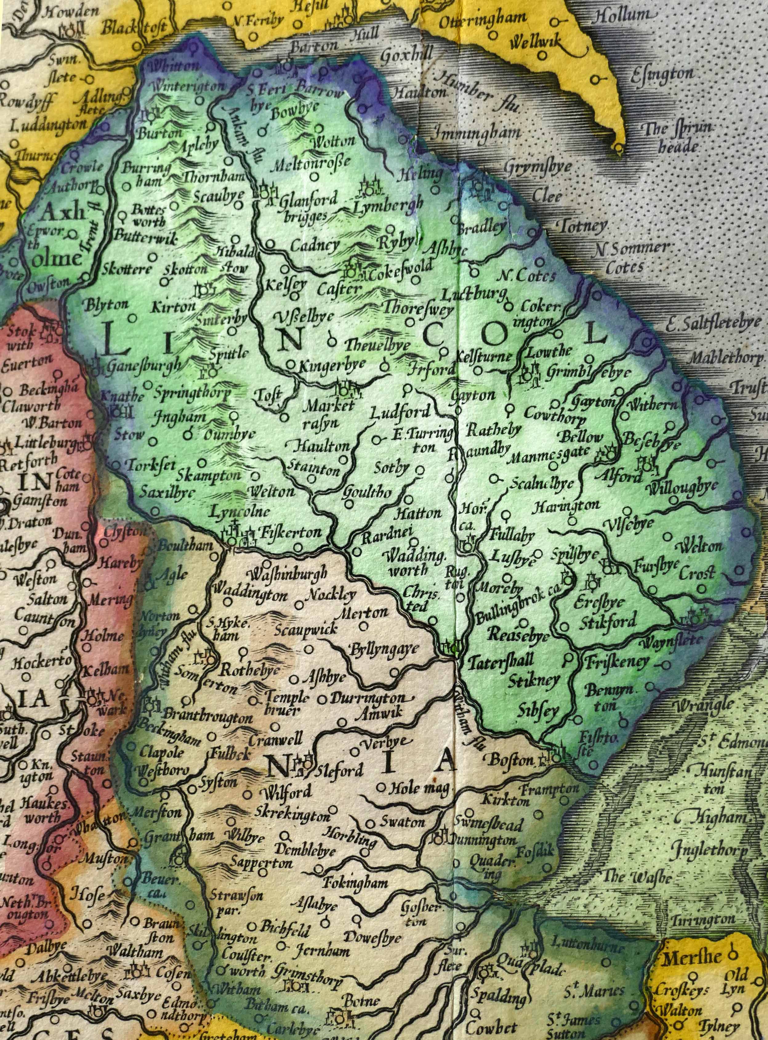
Add to this that this area, like Yorkshire, was heavily settled by Danes over a thousand years ago, after the establishment of the Danelaw, and effecting place names in the area. The most widespread are villages ending in by with Lindsey’s South Riding having more than anywhere else in Britain. There are many other less obvious Danish derived names such as gate for road, wath for ford, beck for stream, dale for valley and other settlements ending in thorpe. So to describe this hilly wold landscape in detail it seemed reasonable to use Scandinavian words given to natural features across northern England especially where they had not been previously named on maps.
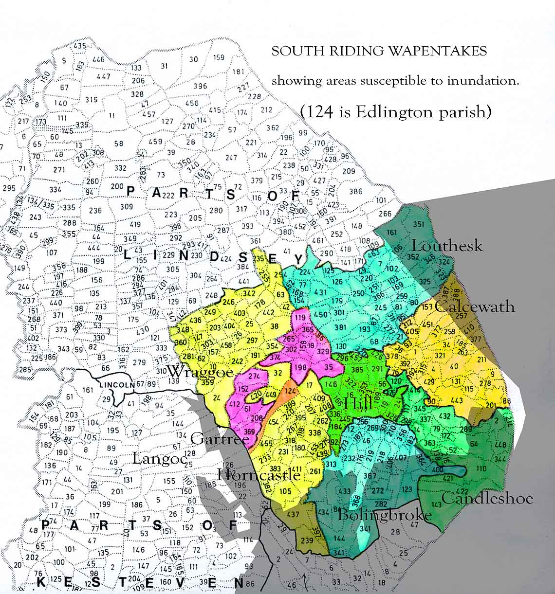
At the time of the Danish settlement in the region the county of Lincolnshire had yet to be formed yet Lindsey had been in existence for centuries. It possibly dates back as far as Kent as a minor kingdom formed soon after the Roman legions left and like Yorkshire it was important enough to be split into ridings. These were the west, north and south ridings but it is the last of these that we shall be discovering. This covers an area east of the River Witham across to the coast and stretching roughly from Louth to Boston and covers an area similar to present day district of East Lindsey. During Tennyson’s time the South Riding was still split into sub divisions called wapentakes which is derived from the Scandinavian phrase “take your weapon”.
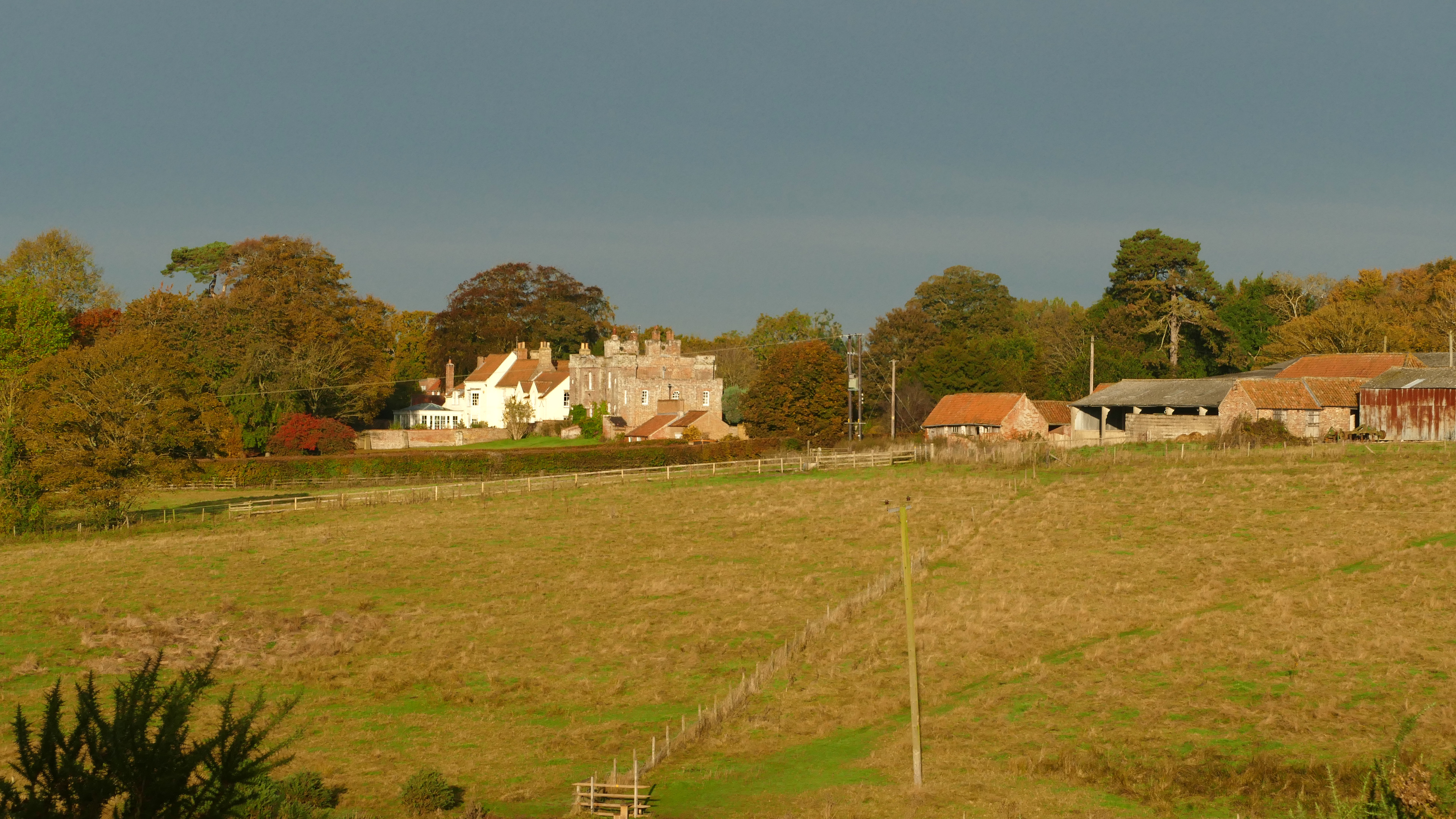
In the South Riding all the wapentakes include an area of the Wolds with each stretching out in different directions to the coast or the River Witham to include an area of marsh land and often access to navigable water. The exception to this is Hill wapentake which is entirely confined to the southern Wolds and in its centre are the twin villages of Somersby and Bag Enderby which during Alfred’s childhood were ministered by his father the Reverend George Clayton Tennyson.
Hill wapentake is bisected by Lymndale whose complex course and formation will be central to discovering and understanding the area where Tennyson grew up. In fact Hill wapentake is Tennyson country and is defined by the River Lymn and its dale. The journey of discovery on which we are about to embark however will start in the wapentake of Candleshoe to the south east and follow the Bluestone Heath Road for some distance to enable me to give an overview from this ancient ridgeway of the wider area before exploring the more secluded country where Tennyson spent the majority of his first twenty eight years from 1809 to 1837.
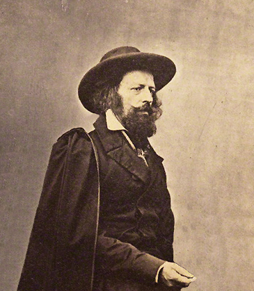
The eighty two years of Tennyson’s life bridged two ages. When he was born the fastest thing he would have seen close up was a galloping horse and the noisiest thing he would have heard was a thunderstorm. This as with any weather event would have been deemed an act of God. By the time he died he had been photographed many times and even had his voice recorded reading his famous poem Charge of the Light Brigade. Both things would have seemed impossible when he was young. The internal combustion engine had just been invented so the world was about to get even busier and noisier. More fundamentally, after years of meticulous data gathering scientists were finally beginning to understand the mechanics of weather systems so that instead of accepting storms as divine judgement they were beginning to be understood and even predicted.
Darwin, Tennyson’s contemporary, and other great scientists and thinkers were questioning the age of the earth controversially pointing to geological evidence that suggested it could be millions of years old. By the time Tennyson was in London during the 1840s he would have come across people with ideas that fundamentally questioned the old order of things. At a social level the Chartists and Karl Marx were challenging the establishment. By the 1850s trains could transport most of the population efficiently to most parts of the country and Brunel was building steam ships to take people in comfort across oceans. Towards the end of Tennyson’s life the telegraph further changed the world. By the time of his death in 1892 this news could be sent as far as North America and even Australia almost instantaneously. He was one of the first global celebrities whose poetry was known and loved by millions compared with Shakespeare whose work during his lifetime was only able to reach a few thousand. Yet despite this much of Tennyson’s work described a pre-industrial, if sometimes idealised, world inspired by his simple rural upbringing in Lymndale, which people crammed into grimy industrial towns would yearn to escape to.
Another contemporary of Tennyson was Ruskin who saw his role as trying to prevent some of the greater excesses of the industrial revolution and along with the Arts and Crafts movement and the Pre-Raphaelites, who Tennyson was also closely connected to, offered a more traditional and conservative alternative. Ruskin though for all his opinions and followers was a privileged and solitary man while Tennyson as part of a large family wrote mostly about relationships and feelings often in a bucolic setting but were most effective when framed with images of the Lindsey countryside. Both made statements that are still relevant today but only Tennyson could have written “Tis is better to have loved and lost, than never to have loved at all.”
It was not until towards the end of Tennyson’s life that enough data had been gathered for it to be internationally recognised that there had been at least four major glaciations in the distant past that had not only effected the Alps but much of northern Europe and North America. At first Britain was slow to investigate this until it was realised that in the Scottish Highlands and the Lake District could be found all the characteristic features of glaciation that were to be found in the Alps. Indeed it came to be realised that glaciers had once reached as far south as north London.
Tennyson’s writing is still relevant today as we are going through a tech revolution which is just as disruptive as its earlier industrial counterpart. Like two hundred years ago there are great leaps forward being made in science but with consequences that do not always sit well with the natural world. With the help of the latest technologies farming is now incredibly efficient and despite a growing world population is able to produce surpluses but at the same time nature is being more and more marginalised.
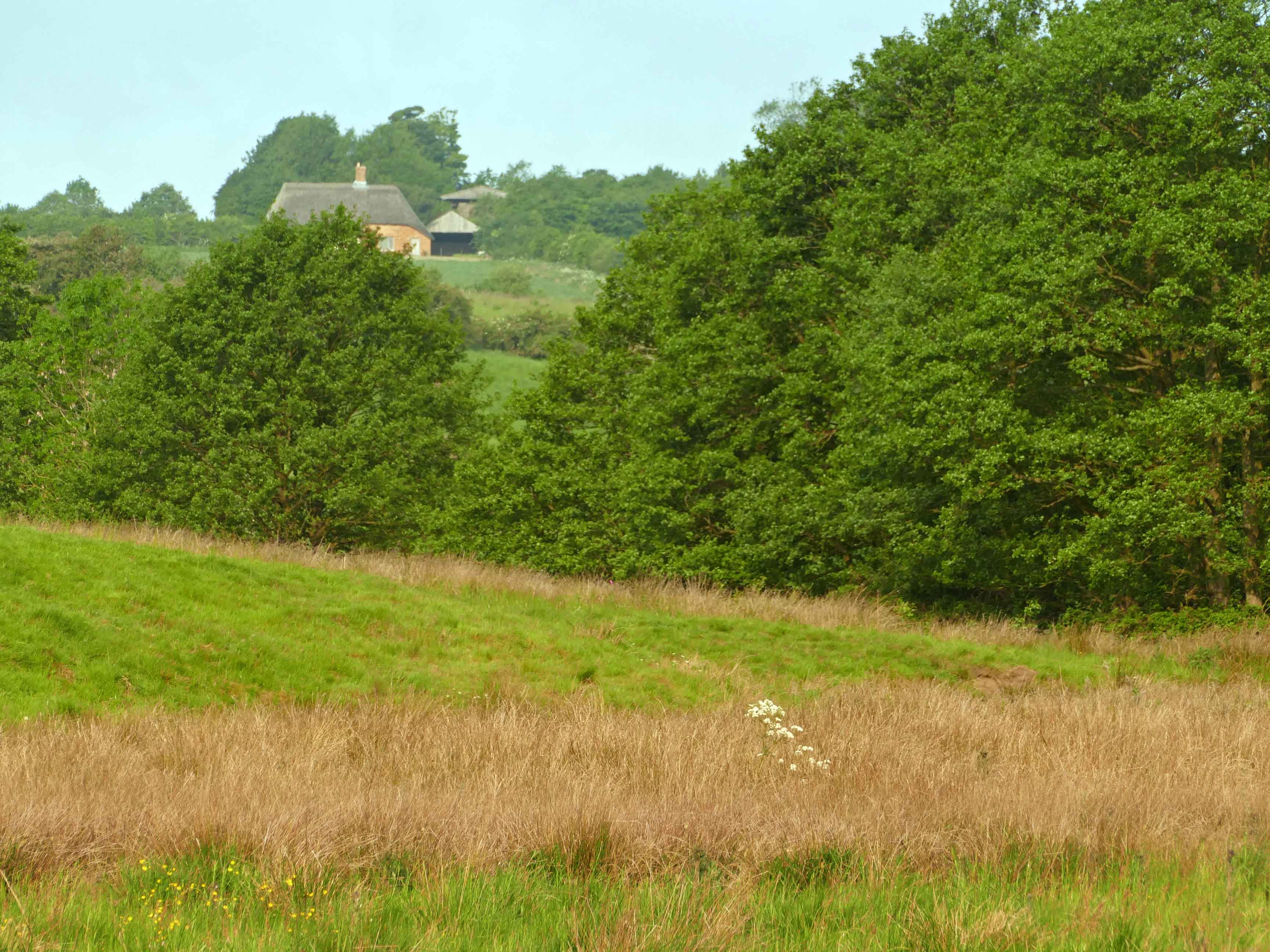
Lincolnshire is in the forefront of modern farming with huge fields of barley and rape draping the wide open hills of the chalk wolds to the intensive vegetable farming centred on the fertile fens. Squeezed in between the two is an older more fragmented landscape which as yet has not changed to radically. In the centre of this area Tennyson grew up two hundred years ago and amazingly would still be recognisable to him today.
We can call this area Tennyson Country and covers most of Lymndale but conveniently for this blog the mostly forgotten medieval jurisdiction of Hill Wapentake covers it too. Tennyson’s birthplace of Somersby is situated in the middle of this area which remarkably and rarely these days still remains mostly untouched by much of the modern blight of the last two centuries. Alfred was born when the Industrial Revolution was in full swing not far away in the North and Midlands but had yet to touch a slumbering Lindsey and especially its South Riding.
( See “Discovering Tennyson Country”, post 06/07/2019, for a more detailed introduction to the locality where Tennyson spent the most of his first and formative 28 years.)
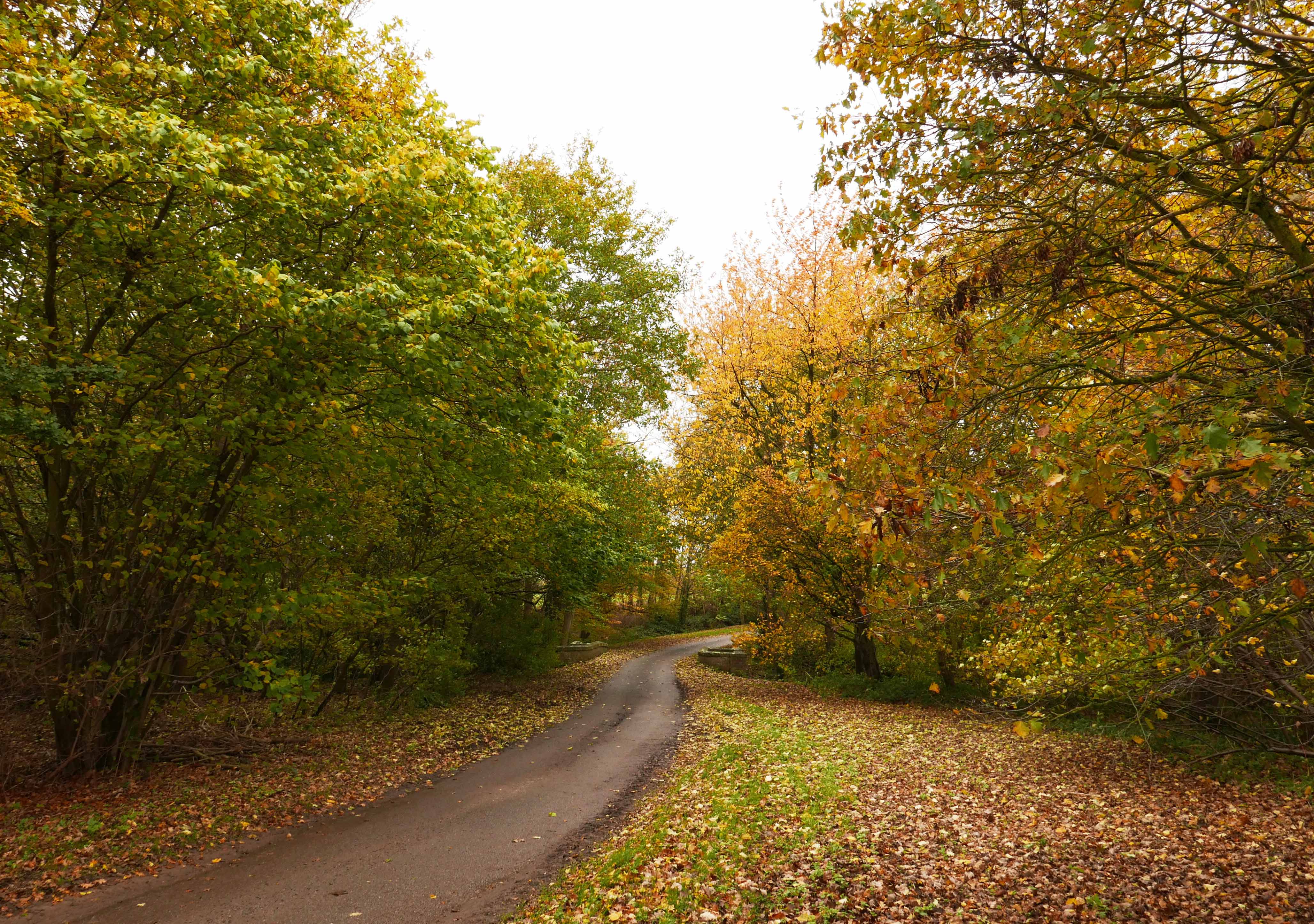
The date of Tennyson’s birth in 1809 was just as significant as the place and the two together allowed him in later life to often refer to a life and landscape that was quickly disappearing and today only remains in small pockets. Hill Wapentake is one of those pockets and the natural living landscape of Lymndale needs protecting. Ideally it needs enhancing so that it can once again harbour the diversity of wildlife that was such an inspiration to the young Alfred. As this is essentially the catchment area of the River Lymn confined between surrounding hills with a different geology to the rest of Lincolnshire it does stand out as an ideal area to award special protective status.

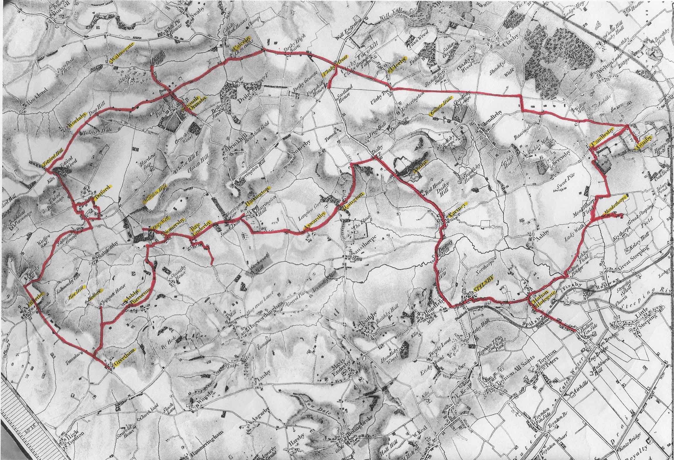
The route I have chosen around Tennyson Country starts at the small hidden Baptist chapel in Monksthorpe which itself is a tiny and well hidden hamlet. The route heads north past Gunby Hall before ascending onto Long Rigg following the Bluestone Heath Road which we continue to follow along Worlaby Rigg before beginning the return journey via Tetford, Roach Ridge and Lymndale to finish at Spilsby, just a short distance from the little chapel where the journey began. By then I hope you will see this forgotten corner of the kingdom in a new light.
Long Rigg is the longest of the four characteristic ridges in this area. Along with three others Brinkhill Rigg, Walmsgate Rigg and Worlaby Rigg all are ridges of chalk extending from the made body of chalk at a height of between seventy and a hundred metres asl. Beyond Tetford Hill however the Bluestone Heath Road continues along a narrow ridge curving round the deep bowl of Oxcombe to the east with broad views inland to the towers of Lincoln cathedral to the west. This high narrow ridge which eventually climbs to nearly 150 metres asl needs to be included and called High Rigg. The edges of these flat topped ridges are normally steep and indented with deep combes. The only exception is Walmsgate Rigg which is isolated from the main body of chalk by prime examples of steep glacial melt water channels. As they all have similar characteristics I chose to call them riggs, which is a term found in the North Yorkshire Moors for a long ridge, often used as drove roads, like Rudland Rigg and there is the hamlet of Rigsby (spelt with a double g on old maps), meaning farmstead on the ridge which is found on the eastern flank of the Wolds not far from the named riggs.
Today we are constantly told erratic weather conditions are evidence that the climate is warming. As the weather system gains more energy floods and storms are becoming more widespread. Now imagine the exact opposite of this. 20,000 years ago the Earth was going through a phase when it was receiving less heat from the sun so there was much less energy in the atmosphere. In fact weather systems became locked into a repeating relentless cycle lasting decades if not centuries. Storms are mostly formed out at sea and with an energy rich atmosphere are able to travel far inland keeping the continents well supplied with rain. An atmosphere low in energy, as during the ice age, does not have this ability and storms are restricted to circulating round oceans only effecting the margins of the continents especially away from the tropics. Only for a brief period each summer does it ever rain inland. The continents remain mostly dry and cold with only tundra and steppe grazed by vast herds of cold adapted animals like mammoth and reindeer.
Because of this persistent cold precipitation for nine months of the year falls as snow even at relatively low levels at latitudes similar to Scotland. Here on the western edge of the Atlantic this promontory off an enlarged and otherwise mostly dry continental land mass would have been incessantly battered by storms bringing raging blizzards that soon filled up corries. The shear weight of snow then compacted into ice, which flowed slowly but with great erosive power down valleys. Eventually individual valley glaciers would coalesce into broad ice sheets which spread out across lowland plains. Constantly fed by fresh snows and with only brief periods of thaw in mid summer these ice sheets spread further and further from their source to eventually cover much of Britain. This dramatically altered the landscape by bulldozing material out of the mountains. This material known as till along with the ice itself changed the course of rivers and blocked others to form large lakes. When these lakes overflowed they would often cut new valleys. The best example of this is the River Severn whose course through England went from flowing north to flowing south as it continues to do today. Even the course of the River Thames was altered by the greatest of all ice sheets 400,000 years ago. The landscape forms created by the presence of the most recent ice age in East Lindsey are on a much smaller scale but can be seen and interpreted quite easily from the ground whereas larger features can only be defined from the air or appreciated on a map. The melt water channels cutting through the Lincolnshire Wolds are small but many and are able to tell the story of the last glacial maximum just 20,000 years ago in great detail.
