Langton is placed in the middle of an area once nick named “Spilsbyshire” for it was distinguished for having so many grand houses or halls in the locality. Many still stand today in Langton’s neighbouring villages but some have been lost like Eresby Hall, the grandest of them all, on the edge of Spilsby. Langton’s attractive and sheltered location would also be expected to have its hall and in Tennyson’s youth it did. This stood west of the present village and was the third incarnation of Langton Old Hall but it too did not last.
In 1867 it was decided to build a new hall in the Elizabethan style over on the eastern edge of the village. Described enthusiastically by White’s 1892 Directory it states “It is situated on an acclivity about half a mile east of the original hall, well sheltered from the north and east by a large wood and commanding extensive views of the surrounding country. The grounds and fish ponds, which are very beautiful, were designed by and completed under the supervision of Messrs Veich of London, the eminent landscape gardeners.” Sadly nothing remains of either the house or garden but just a kilometre to the east is Dalby Hall. Although not in the “Elizabethan style” and with no gardens by Veich of London it is situated on an acclivity with shelter from the north and a right of way passes between the house and the fish ponds that carries on to Skendleby and well worth investigating. (See Partney & Spilsby Blog.)

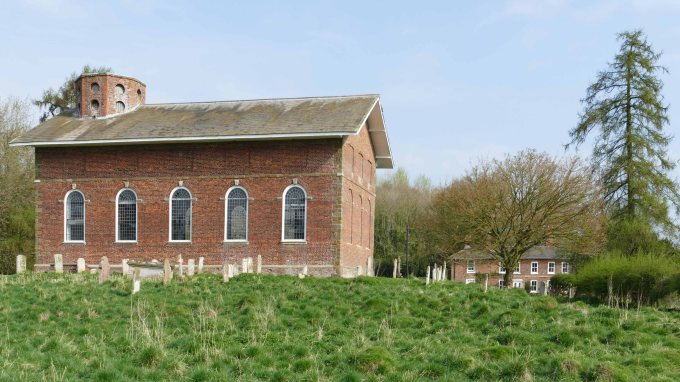
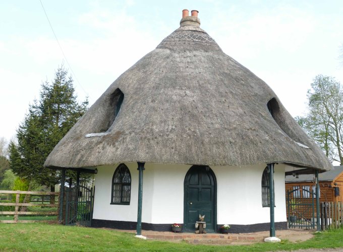
Although Langton can no longer boast a grand hall today Tennyson would still recognise the surrounding landscape because the woods that surround the village were in existence in his day. Today the pretty village hidden away between these belts of trees, is seldom visited. Entering from the south the lower woods are damp carrs along Stirbeck and behind the village a belt of woods clings to the steepest sections of Langton Edge. Langton’s seclusion is increased in that after passing between the Georgian brick church and the rectory of the same period and brick, the road does not go through the centre of the village but kinks to the right after passing a curious conical thatch roofed cottage. The road then curves right again to climb through the woods clinging to the hillside passing the entrance to the long gone Victorian hall but might be behind the road’s detour away from the village. At the top of the hill the road takes a sharp right east and then after two more sharp bends joins the A16.
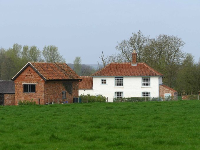
This meandering road and the surrounding woods, especially Langton Carrs which is the longest carr corridor in the lower dale makes the village feel very isolated and yet on either side of Langton there is a main road no more than a mile away. At the quiet northern end of the village is a large house called Old Inn Farm, which intriguingly suggests that the village was not always so quiet and secluded and whether an older road took a much straighter route north heading directly passed Spellow Hills and onto the ancient Hub.
It is possibly two centuries since the inn became a farm but fortunately the name remains. The building itself is not particularly ancient, although a thorough examination might discover otherwise, but it stands on a lane whose course once went right through the village. This still can be made out and even followed by standing beside the curious conical cottage and looking north along an avenue of limes to the white Old Inn Farm at the far end of the village where the land starts to climb. This is a classic location for old inns because for such a steep climb it would be necessary to change or at least refresh the horses before being expected to pull a coach or cart up such a steep incline. The HG website even records evidence of an early trackway 400 metres north of Old Inn Farm.
All this points to Langton, which means long village, once being strung out along an important north south route connecting the main fen causeway south of Bolingbroke to the ancient Hub near Ulceby to the north. This however would necessitate a steeper climb onto the chalk plateau than the present road or that of the A16 just a kilometre to the east. This though only increases its ancient credentials back to a time when pack horses were the favoured means of transport or even back to the Roman period, when as with the example of the Roman road, which climbs the north side of the chalk plateau up to the ancient Hub, shows they were not put off by such steep inclines.
The direct, possibly Roman route, from the Hub to Bolingbroke passed Spellow Hills Long Barrow, through Langton passing close by Roman Aswardby and crossing the River Lymn south of Sausthorpe. This crossing point was much more practical than at Partney where the modern A16 crosses because at Partney the road has to cross a bigger river, a main tributary (Stirbeck) and a much wider flood plain. Today just beyond Sausthorpe the bridge is next to the River Lymn’s confluence with the Snipe Dales Beck. The beck however has been straightened and looks like a roadside drain but in Tennyson’s time it meandered erratically away from the road across a flower filled meadow.
From here the ancient road heads south across a wide part of the sandstone ridge. This section was used as a parish boundary by several villages, which is a good indication that it has been used right back into prehistory. Following the high ground as long as possible it passes two kilometres east of Bolingbroke and three kilometres west of Spilsby before dropping steeply off the most southern point of the Wolds to join the fen causeway across to Boston, which follows the relatively high ground of the terminal moraine from the last glacial maximum.

There are two possible reasons why this route was finally abandoned. There was the increase of coach traffic from the seventeenth century onwards but before this the growing importance of Spilsby at the expense of Old Bolingbroke as a market town encouraged eighteenth century toll roads to be built east of the old road. The Gough map of Great Britain, which is the first roughly accurate map of our island dating from the 1370s “with a very precise description of Yorkshire and Lincolnshire” – Dr. Elizabeth Solopova, shows nearly 5,000 kilometres of roads as red lines. Most are concentrated in the east of England. In particular there is a clear red line running south from Barton passed Caistor to Horncastle. From Horncastle the red line continues through Bolingbroke to Boston with a line veering off along the then coastline to Wainfleet.
Spilsby is the only town in the area not marked on the map. As then it had only just been granted a market with Bolingbroke still the main centre of the southern Wolds. Co-incidentally the Gough map was produced close to the date when Henry IV was born (1367) in Bolingbroke castle and baptised in the grand church his father, John of Gaunt, had built next to its imposing walls. Unfortunately only the tower and the south aisle of the church and the footings of the castle remain of this high medieval splendour.

Today from the top of Langton Hill it is possible to continue north on foot along a farm track, which is part of a permissive footpath. This heads straight towards Spellow Hills for 600 metres before it turns left towards Northdale. This is more of an amphitheatre cut into the Langton Edge from which a spring issues to run down to Stirbeck*. The permissive path follows the top of this steep slope following the curving nature of the high scarp edge eventually leading back to the road. This part of the route offers immense views across Lower Lymndale to Roach Ridge in the west and south over to Spilsby. The slope itself is rough pasture but on old OS maps it is marked as cultivated terracing. This is possible but it is clear to see from the top of the slope at least two old track ways. One emerges from the wood and goes directly up hill parallel to the field boundary but another cuts diagonally across the field only to eventually cut back to rejoin the first track in the top corner of the field thus creating a much gentler incline by incorporating of a hairpin bend in to the climb.
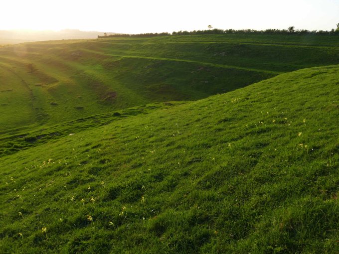
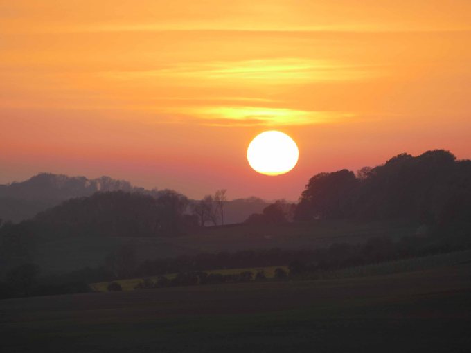
From the top of the Langton Edge there is no better place to admire the unspoilt view across Lower Lymndale and be grateful that is not blighted by any modern eyesores or intrusive sounds of machines. A view that Tennyson could still appreciate if he were still alive. It is also a good place to ponder again these lines from the the HG website
The name ‘Spellow Hills’ is derived from the Old English ‘spel’ and ‘hlaw’ or ‘haugr’ which means ‘assembly mound’. The earliest recorded instance of the name is in the early twelfth century. The barrow lies just below the crest of a gentle rise 200m to the west of the A16 which marks the boundary with Dalby parish. The land rises gently to a point 1.2km north where the wapentakes of Hill, Calcewath and Candleshoe and the parishes of Langton, Driby, Ulceby and Dalby meet (TF 406 733). From here there is an extensive view in all directions. It seems highly likely that this was a meeting place for the people from all three wapentakes rather than that of a single unit.
*Stirbeck on the OS map is most likely a corruption of Skirbeck, which is old Danish for bright or clear stream. As this is the only tributary of the Lymn that is a chalk stream its clear waters would stand out.