Gartree is a wapentake adjacent to Hill. Its eastern boundary is the section of the ancient ridgeway known as the Bluestone Heath Road stretching from Belchford to Donington on Bain. This is nearly twelve kilometres long and both parishes are within its boundaries. Like all other wapentakes, with the exception of Hill, it stretches from the heart of the Wolds down to some navigable water. In Gartree’s case this is the River Witham, which its western boundary follows for four kilometres. The distance between the two boundaries is twenty kilometres, with the eastern boundary at 150 metres above sea level. To the west of the ridgeway is the steep face of the scarp slope, which faces a broken line of lesser hills before ultimately descending a hundred metres down to the River Bain a few kilometres to the west. There is a small rise up to Caistor High Street before the land gradually falls away down to the River Witham at just three metres above sea level (asl). In this blog I will be concentrating mainly on the eastern hilly part of the wapentake between the High Street and the Bluestone Heath Road.

Tennyson’s father died suddenly in 1831 at the age of 52. Despite his father’s death Alfred and his family were able to continue living at the Somersby rectory until 1837. He was still only 21 when his father died and Alfred and most of the family were not financially independent and relied on his rich uncle Charles Tennyson MP for some support. The successful uncle lived in a large manor near Tealby some 30 kilometres (20 miles) northwest of Somersby. Despite an uneasy relationship between them this would have meant that Alfred would have needed to visit his uncle at times travelling north along either the Bluestone Heath Road or Caistor High Street.
Between the Bluestone Heath Road and Caistor High Street, is the area I have called the Gartree Hills with its northern limit being the tiny hamlet of Biscathorpe and the southern boundary stretching roughly between Hemingby and Belchford. Geologically this area is remarkably similar to Lymndale or Tennyson Country and when Alfred passed through it would have seemed very similar to the landscape where he grew up. It could be argued even that his famous poem “The Brook” is more about the River Bain rather than the River Lymn as the description of its course fits much better. (See The Brook blog.)
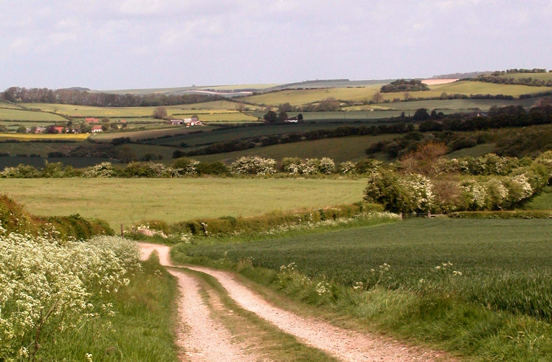
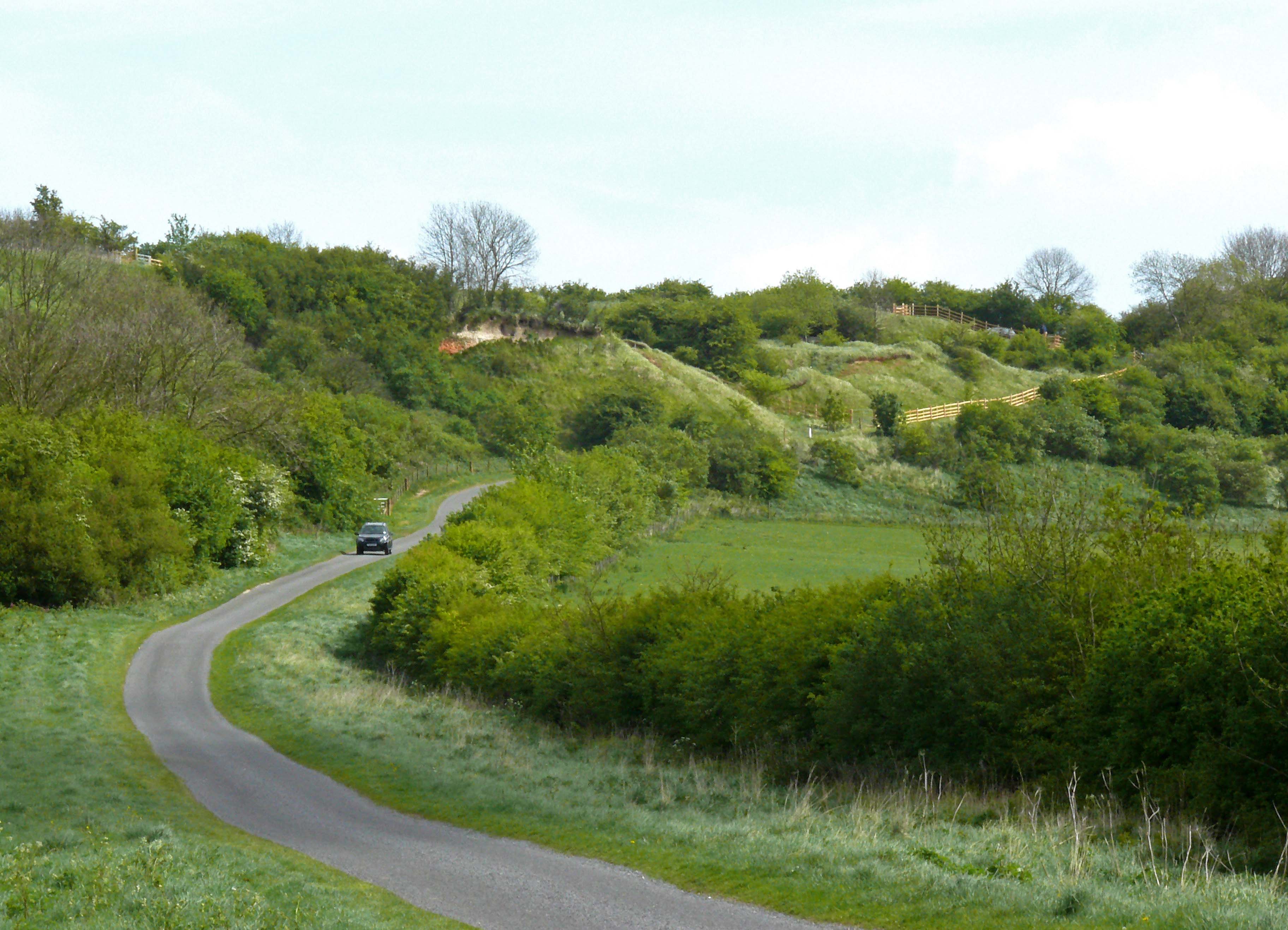
The Bain and Lymn valleys too share a similar network of narrow lanes that climb and dip over small hills and curve round small woods to link hidden hamlets that are discovered rather than merely reached. This is in sharp contrast to the roads up on the chalk escarpment to the east. These are younger built straight with wind verges for moving large flocks of sheep and follow the ridges that offer wide views of open fields. (See Central Wolds Challenge Blog.)

Just like in Lymndale the Gartree villages are set on the sandstone plateau beneath the escarpment but above the river, which only has disused watermills for company. Detached from the escarpment are also a number of hills of Roach stone as in Lymndale but here they are more often capped with Claxby ironstone and the Roach stone soon peters out north of Red Hill. Half way up Red Hill is an exposed band of red chalk by the road. Only here and in a number of similar locations along the scarp slope such as at Belchford Hill is this rare type of rock visible unlike in Lymndale where it is clearly exposed on the hills separating the upper and lower dales.
The series of Roach stone hills continue through both wapentakes reaching to about 140 metres asl in the west. The chalk escarpment also passes through the two ancient jurisdictions and peaks at just over 150 metres asl. where it bulges west away from the Bluestone Heath Road near Stenigot. This is ten metres higher than Tetford Hill, which dominates Upper Lymndale. (See Upper Lymndale and Roach Ridge Views Blogs.)
If you section the whole length of the Lincolnshire Wolds into three, using the coast roads of the A158 in the south and the A631 in the north as boundaries, the central section between Hagworthingham and Ludford, which includes Tennyson Country and the Gartree Hills, is most emblematic of the Wolds offering the full range of features that this small but varied range of hills has to offer. To the north the hills although slightly higher are largely chalk and to the south sandstone predominates. The central section described is well watered with several streams and rivers having cut valleys through the layer cake geology creating a diversity of ecological zones which would be hard to beat anywhere else in lowland Britain.
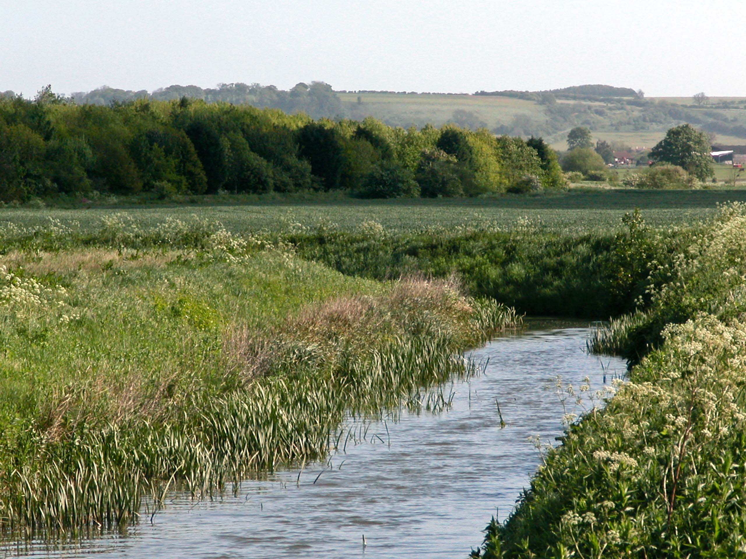
The landscape of the mid-section of the Bain valley overlooked by the Gartree Hills has much in common with Lower Lymndale in that the landscape is much more intimate than the surrounding hills. This can be seen quite clearly on Google Earth when panning back from Goulceby where the fields surrounding the village are small and mixed. This contrasts with east of the Bluestone Heath Road on the chalk escarpment and the clay lands west of Caistor High Street where the fields are large, open and predominately arable.
This contrast is mainly down to the mixed geology of the Bain valley, especially in the break between the plateau of dry sandstone on which most villages stand and the damp clay valley bottoms occupied by the River Bain and its tributaries. This is also the case in Lower Lymndale as is the slow meandering nature of the two rivers whose natural erratically winding courses along these mid sections of their profiles have avoided being straightened which is not the case lower down their courses.
The geological boundary is most stark at the entrance to Silverines Nature Reserve and across the road in the large arable field opposite. Although small the nature reserve is in extreme contrast to the monoculture of the field, This is because it is cut through by the boundary between the dry sandstone and damp clay and allows for an impressive diversity of flora for such a small area of just six hectares. The western edge of the reserve has a strip of woodland which is a northern outlier of the many carrs that are to be found in Lower Lymndale. The carrs there though are larger and more numerous because the sandstone there is more heavily dissected as a result of heavy erosion due to the outpouring of meltwater during the last glacial maximum that the Bain valley missed. (See – Wild and Wet Carrs Lower Lymndale.)
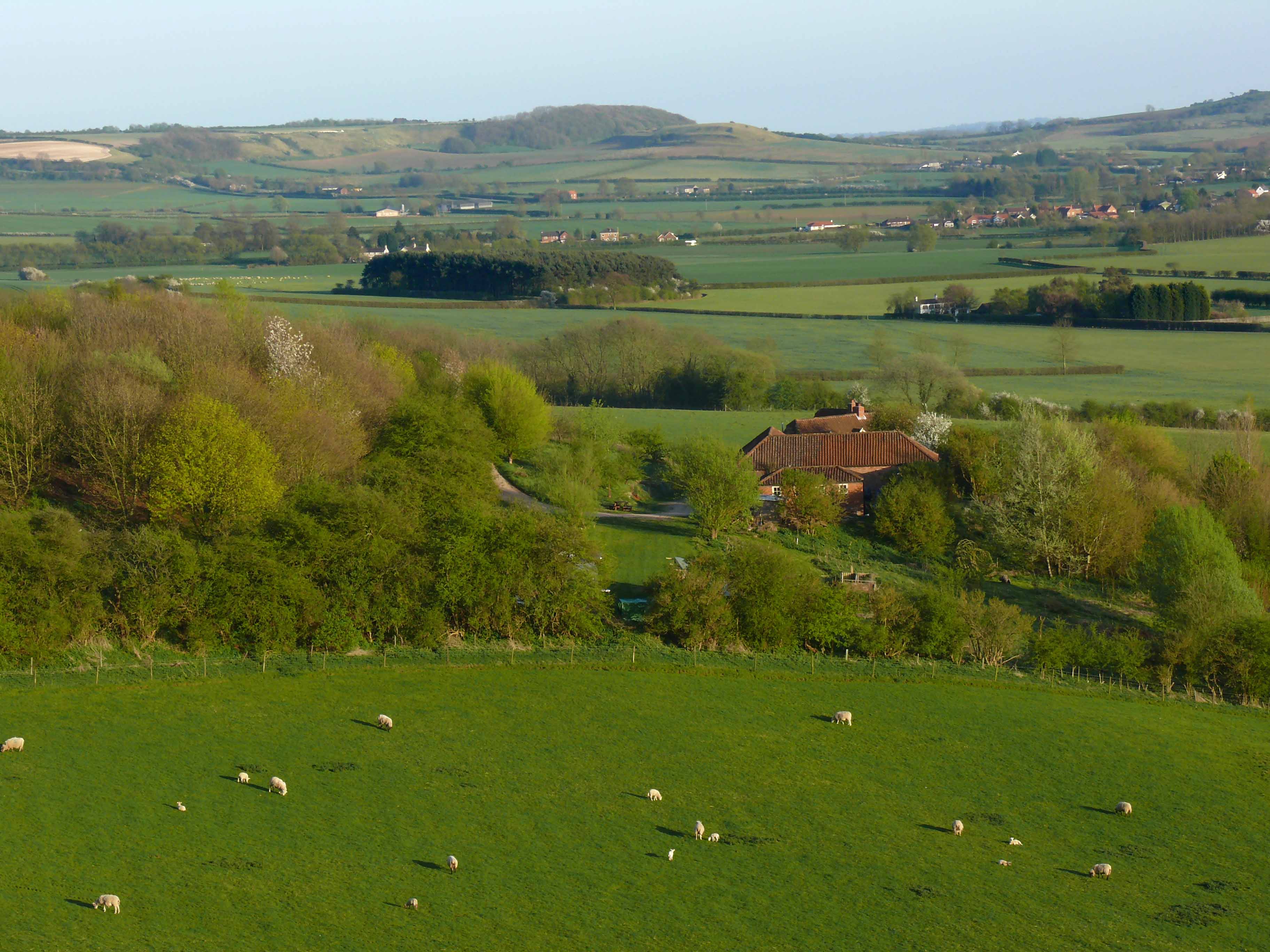
From the top of Redhill looking south there is a view which encompasses much of the Gartree Hills and to use a line from Tennyson reveals “a circle of hills”, sometimes used in reference to the similar landscape around his Somersby home. The counter view from Flint Hill, near the Poachers Hideaway, of the chalk ridge which stretches north and eventually hems in the River Bain among rolling hills is as good if not more impressive. To find the best view though it is necessary to go back south into Hill Wapentake and look north from Castcliffe Hill north of Fulletby. From here all the Gartree Hills line up neatly ascending in height with Park Hill in the foreground, Gaumer Hill peeping up behind it overlooked by Grove Plantation clinging to the steepest of slopes and beyond stretching out along the distant horizon is the high point of the chalk escarpment overlooking Stenigot.
The other thing that Gartree and Hill wapentakes share is that they are bisected by a Roman road that connects Lincoln with the coast near Skegness. The central section which passes through the two wapentakes has long been abandoned and in Hill wapentake is sometimes difficult to follow but the section through Gartree, west of the A153, is easy to spot on ordnance survey map as a straight bridle way heading WNW from the main road just west of Belchford.
After crossing the River Bain it forms the northern boundary of the long parish of Great Sturton. The bridle way forms the whole northern boundary of the parish but the Roman road disappears halfway along it to reappear a kilometre further on as a metalled lane forming the northern edge of Sotby Wood. The bridleway meanwhile bends to head WSW nearly to the end of the parish. This is the narrowest part of Gartree wapentake and from this point it heads down to the River Witham.
The area described above, which lies between the villages of Great Sturton, Sotby and Hatton, lying on the western edge of the Wolds, is good for easy walking and off road biking and is little visited. The following blogs of the Tennyson Trail and Central Wolds Challenge will explore the many other opportunities for getting out and about on foot or by bike around this varied and interesting section of the central Wolds.

