The A158 coast road from Horncastle to Skegness, apart from busy weekends during the summer, is a delightful road to drive along. This is especially true in early morning when mist lingers in the Wolds valleys having yet to be disbursed by the strong rays of the sun rising up from the North Sea. Or late in the evening when a low sun in the west throws long shadows over the valleys.
From Horncastle the road rises gradually a hundred metres up to Round Hills Holt (129m.) and then gently descends a hundred metres down to the River Lymn east of Hagworthingham. The only two places where views are restricted is through the village and just west of it. This is because the modern road cuts through Scalp Hill. The old road however chose to avoid this eminence by skirting round its north side. Although the new road is wider and faster it does not afford the extensive views across Lymndale that the old road does. For the traveller not in a hurry to reach their destination the old road is still accessible and can be followed from a kilometre west of Hagworthingham. Narrow and hidden between high hedges it is only used by those that need access to their houses or farms. The lanes that lead down to these dwellings offer vantage points over what was Tennyson’s backyard to the villages of Somersby, Bag Enderby and Ashby with Warden and Tetford Hills on the skyline behind. Between the A 158 and Somersby except from the valley bottoms the land is mostly Spilsby sandstone whose basic characteristics are the same west of both Somersby and Hagworthingham. (See Damp Dale & Ashby…)

Although Hagworthingham is not usually included as a one of the Tennyson villages its northern edge (Mount Pleasant) is only three kilometres from Somersby. Today it seems much further because by road it is seven kilometres away. This would not have concerned a young Tennyson though who would have thought nothing of walking between the villages and even today there remains a number of ways to do this using footbridges to cross the River Lymn and its tributaries. Ashby meanwhile, whose church can be seen clearly from the old road, is a distance of eight kilometres to Hagworthingham by road compared with three kilometres by foot.

The other feature that the modern route of the A158 obscures are two geological faults that cross it between Scalp Hill and Hagworthingham. These are unusual for the Wolds with the only other significant fault in the area at Driby (See Green Hill Blog.). The faults that cut across the coast road in a northwest-southeast direction are only about a mile long and face each other and could be the remaining evidence of a major landslip which occurred during one of the ice ages.
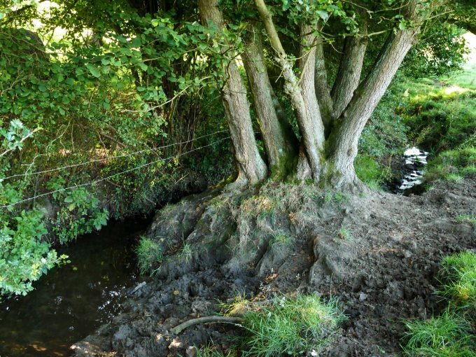
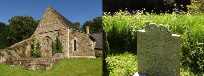
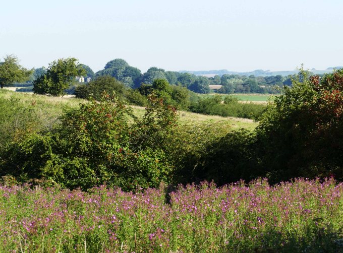
The two faults effect on the landscape, though at first not obvious as it is mostly obscured by trees, is that they created two narrow but deep valleys between Scalp Hill and Hagworthingham and create a break in the Claxby Ironstone that caps the hills around here to expose the thicker bed of Spilsby sandstone beneath. The valley on the south side of the road passes immediately west of Hagworthingham church. Holy Trinity is only a small church tucked away on the edge of the village but has a long history and was grander in medieval times. Despite having had an extensive Victorian restoration its tower collapsed in 1972. If this had survived it would have offered a view over the deep valley that passes beneath it. However the tower’s close proximity to the eastern fault might have been the cause of its demise. The base of the tower can still be seen and just a few yards away moisture loving mares tails and Himalayan balsam encroach close up to the gravestones suggesting a sudden change in ground conditions perilously close to the mound upon which the church tower was built. Even the hollow way that passes beneath the east side of the church is wet from seepages even in dry weather.
Access to this otherwise hidden valley is by a footpath 200 metres south of the church, along this wet lane, close to where its small stream meets the road. It is difficult to spot because new housing fills the valley here and it remains to be seen if they will be affected by the same unstable ground conditions which caused the demise of the church tower. It is noticeable that the rest of this expanding village is built on higher and drier ground to the north and east of the church.
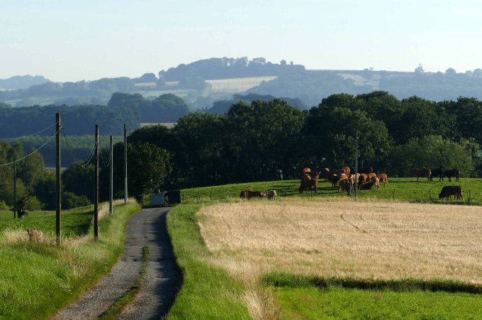
The fault valley to the north of the A 158 is even more obscured but it is worth exploring and fortunately there is access via a footpath on the edge of Hagworthingham close to where the old and new roads merge to pass through the village. The path sets off northwest over a cultivated and flint strewn hill (More evidence of the ice age.) before dipping down into the faulted valley. To properly enter the valley though it is necessary to follow the path through a field chest high in thick weeds and then cross a stream by a footbridge. This final task requires some negotiating because the associated stile is only slightly lower than an overhanging bough immediately above it.
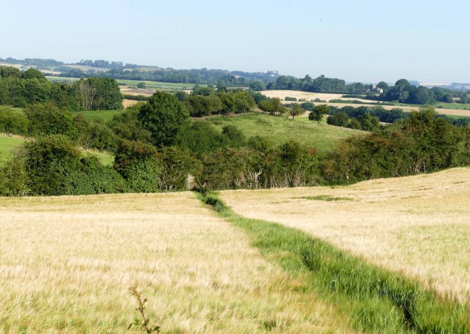
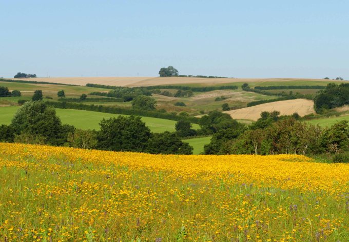
These difficulties are amply rewarded however because revealed before you is one of the most picturesque valleys in the Wolds. This hidden dale is steep and narrow with a stream flowing along it which emerges from a wood at the top end of the valley. The path by which you entered the little dale continues down the valley, which is old pasture with cattle, and crosses a second stream. This merges with the first and after only another 150 metres their waters join one of the River Lymn’s larger tributaries flowing east having itself started life in more steep sided valleys just two kilometres to the west.

Although the valley just described is barely a kilometre long it deserves a name. Its rugged untamed nature together with its brevity makes it deserving of the title Little Dale. Although well hidden and easily overlooked, despite being a few hundred metres from the main road (Yet it is not possible to hear traffic when in the dale), it is still one of the most accessible of the many little valleys that are to be found this side of the ridge between Greetham and Hagworthingham. Because of their steep sides and the many little streams that issue from their slopes parts of them have always been left over to pasture. On the government official land use website (www.magic.gov,uk) this comes under the description of good quality semi improved grassland. This uninspiring title means that these fields are likely to be a havens for a variety of wildlife which would otherwise struggle to exist in the large arable fields that overlook these little valleys. Recently the magic website has been updated and aspirationally includes this area along with other similar habitats in the Wolds to be, if not protected, encouraged to be preserved or even expanded under stewardship schemes. Specifically Little Dale is deemed within an enhancement zone and close by, just to the west, is an area picked out for possible habitat restoration or creation, which is adjacent to a remnant area of lowland heath.
For now though this area on the very southern edge of the Wolds AONB with its many hidden valleys and forgotten footpaths connecting Tennyson villages is worth exploring, because as with Little Dale it would be a landscape with which the bard would have felt very much at home in and appreciative of the wildlife it harboured. Already in previous posts it has been pointed that Tetford and Harrington had associations with Tennyson at a similar distance from Somersby and Hagworthingham would come into this orbit of the young Alfred’s “backyard”.