Lincolnshire has always been singled out for its big skies and more recently has been promoted as a good location for cloud spotting with its clear air and uninterrupted views but if you had to pick a single location where these characteristics are shown off to best effect then the high ground immediately west of the hamlet of Winceby would be a strong candidate offering broad views across the rolling hills of the Wolds in one direction and high over the distant Fens in the other. The span of this vista stretches along a flat horizon from the slender tower of Boston Stump in the south around to the triple towers of Lincoln cathedral in the west.
The route of the A158 coast road from High Toynton to where it crosses the River Lymn follows a ridge made up mostly of Spilsby sandstone under a cap of Claxby ironstone. If Somersby is set in a circle of hills as described in an earlier post then the southern crescent is made up of this ridge and although the red chalk and white chalk hills to the north of the village are respectively slightly closer and slightly higher it is the sandstone hills to the south that Somersby rectory, where Tennyson grew up, looks across Lymndale to.

The A158 is the present main road to the coast passing Spilsby and heading direct for Skegness but the resort historically is very recent and Spilsby is not ancient either. Skegness was a planned layout of a town built to bring day trippers to the coast by rail. It was built in the second half of the nineteenth century where before there were only sand dunes and marsh. Spilsby goes back 700 years but this too was a planned town built by the Norman elite on what had previously been a bare hill top (See Partney & Spilsby post.) The more ancient main road to the coast veers south from the A158 at the high point of Round Hills Holt (129 m.) passing Slash Hollow, the site of a violent skirmish during the English Civil War. On reaching Winceby it again veers off to the right to continue along the highest part of the ridge before plunging down to the ancient soke centre (predating Spilsby) of Old Bolingbroke from where it strikes out across the Fens to Boston along the route of an old causeway, which itself follows the line of on a terminal moraine from the last Ice Age. It is this ancient ridgeway that marks the boundary between the fretted sandstone part of the ridge and the more gently undulating southwestern side.

The terminal moraine of the North Sea Lobe Glacier, which now is used by the A16 to thread its way between the East and West Fens to get to Boston was dumped here during the last glacial maximum roughly 20,000 years ago. To the west of this line however and particularly on the south western flanks of the Wolds are thick deposits of glacial till or drift (Both words are used on the British geological Survey maps.), which were deposited by a much earlier and more extensive glaciation around 400,000 years ago. East of Horncastle around High Toynton this is between 15 to 20 metres thick. East of the ridge from Fulletby to Greetham and the old main road to Bolingbroke the till only remains on hill tops such as Scalp Hill and Mount Pleasant. The contrast in farming and land use between the heavier till soils and the more complex original beds of rock lying beneath is quite marked.
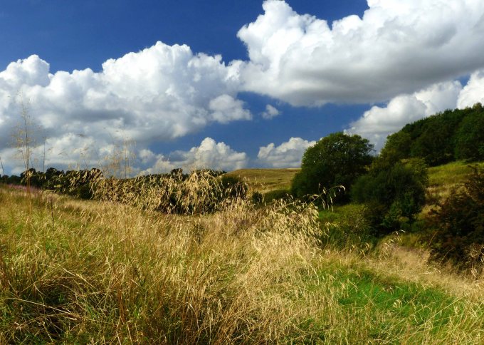
The ridge tops with their thin cap of Claxby ironstone mainly hidden under till have fields that are mainly arable but the steep valley sides are made up of Spilsby sandstone. From Greetham to just past Hagworthingham these north facing slopes are fretted with steep but short valleys as described in the previous post. These mainly have streams issuing out from their sides causing the valley floors to be damp and are often left to grazing. The slopes in between can be clad with trees where they are particularly steep or wet. All this makes for an interesting patchwork landscape and is repeated to the south of Hagworthingham. This is seen most dramatically in the area covered by Snipe Dales Country Park and Nature Reserve where several deep valleys converge. For Lincolnshire this is a site that is important for wildlife offering a broad range of habitats but even further east both to the north and west of Mavis Enderby there are deep valleys that also offer similar habitats. They are respectively Mavis Enderby valley, which has the status of an SSSI (Site of Special Scientific Interest.) and Sow Dale, which is a large nature reserve extending south to the edge of Old Bolingbroke.
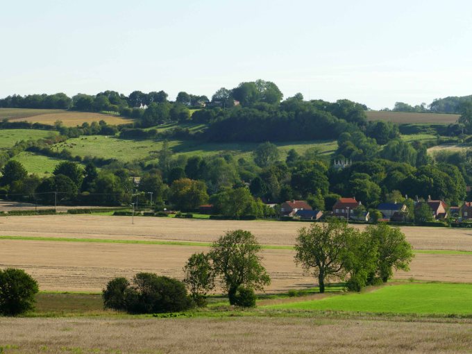
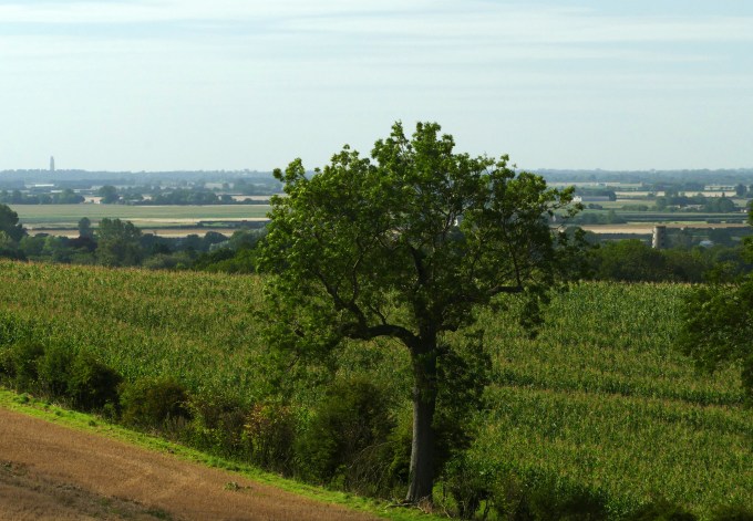
The drift that covered the southwestern slopes of the ridge by contrast are more uniform with less severe contours allowing large fields of wheat to grow in the deep strong earth. These fields roll away into the distance slowly descending to the Fens with only the odd small hilltop village, often more trees than houses, to break the view.
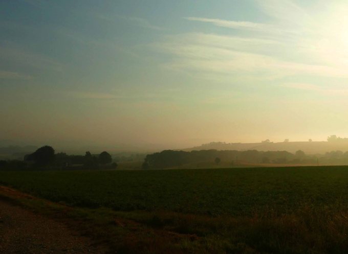
As well as the contrasting farming practices either side of the ridge the vistas in the opposite directions are also noticeably different. This was most apparent one late August morning when from a high point on the A158 I witnessed mist hanging in the damp valleys of Lymndale with only silhouettes of long ridges and mounds of trees standing out against the rising sun. While just 30 minutes later a mile away looking south from a high point on the B 1195 I was looking in the opposite direction over a broad expanse of golden wheat fields descending gradually down to the vast expanse of the Fens. The air was clear and the view uninterrupted except for far to the south where the top of a large storm cloud billowed high into an otherwise clear blue sky.

Both landscape types have their attractions but it is the many steep sided valleys either side of the A158 that are important refuges for wildlife both flora and fauna. The A158, very arbitrarily, was made the southern boundary of the Lincolnshire Wolds AONB when it was first formed. Since then there has been serious intensification in farming practices putting pressure on wildlife especially in Lincolnshire where both habitats and rare species are under pressure. Although small all the important sandstone valleys need to be brought within the boundaries of the AONB. This would mean changing the boundary from following the A 158 to follow the old Horncastle to Bolingbroke road I described above from Round Hills Holt to Winceby, Asgarby and down to Old Bolingbroke. The AONB boundary would then skirt around the northern edge of the village to Keal Hill to follow that road uphill to a crossroads. Here another ancient but little used road (See Langton Old Road Post) passes across the ridge of Spilsby sandstone at its broadest point from south to north to meet the A158 at Sausthorpe. This is essentially an ancient ridge road following a dry upland route with damp valleys either side. To the west these include those either side of Mavis Enderby singled out above which would then lie within the AONB.

There are similar valleys east of the road as well but although they too are worthy of protection they are close to Spilsby and the many popular villages which surround it. Once passed Raithby however it would be possible to extend the AONB east parallel with the A 158 as far as North Beck at the point where it bends to flow from roughly north to north east down to the River Lymn. By following the beck to the river and then beyond it following the Partney/Sausthorpe parish boundary upto the A 158 this would include an extra two kilometres of the River Lymn and its floodplain. Making all these changes to the southern AONB boundary of the Lincolnshire Wolds would effectively incorporate the whole upper catchment area of the River Lymn and all its main tributaries. If all the upper valleys of the River Lymn’s catchment were restored to woods and permanent pasture this would have a positive effect not just on wildlife but also help reduce the risk of flooding downstream on the flood plain near Wainfleet as happened only recently.

