Although the A 158 coast road marks the southern boundary of the Lincolnshire Wolds AONB in the Hagworthingham area, it also passes through some of the most interesting landscape of the Wolds. This main road on summer weekends can be very busy but it also gives easy access to quiet corners of the Wolds that otherwise might be difficult to find such as the Tennyson villages of Somersby and Bag Enderby. For much of the year however the main road is fairly quiet and around Hagworthingham there are plenty of options to stop and also opportunities to get refreshment.

What is less obvious is that there are many choices of tracks, lanes and footpaths to walk along that lead over hills and across streams to the surrounding hidden hamlets. These opportunities can be further enhanced by the fortunate fact that the hourly Lincoln to Skegness bus (Route 56) stops not only at Hagworthingham but several of the other villages surrounding it. This offers the possibility of some longer walks and then to be able to return to Hagworthingham by bus.

To the east there is a direct walk on the south side of the road over to Mavis Enderby and then on to Raithby which has a bus stop and a pub. Or you could continue a little further to the market town of Spilsby where there is even more choice to refresh oneself before returning by bus. On the northside of the A 158 there is an option to take a footpath across Lower Lymndale to Asgarby and on to Langton. From this picturesque wooded village it is possible to carry on along a path overlooked by Langton Edge to historic Partney which also has a pub and a bus stop. Just two kilometres away across the River Lymn and overlooking Partney from its hilltop position stands Spilsby. With the bus stopping at Partney, Spilsby and Raithby this affords many more options for more walks. (See Partney & Spilsby post.)

To the west of Hagworthingham the bus stops at High Toynton and the Horncastle. Although the opportunities to pick up the bus are less, the opportunities for walks are still many. There is also a possible circular walk from Hagworthingham to High Toynton and back, which starts from the bus stop on the A158 in Hagworthingham. From here head south passing below the little church via a sunken lane. At the bottom of the hill near the edge of the village there is a footpath that takes you through the Aura Soma eastate with its modern stone circle and recently planted vines and on through Snipe Dales Country Park and Nature Reserve, which offers many paths to explore including an option to return to Hagworthingham. (See A White Snipe Dales.)
The public right of way cuts diagonally across the nature reserve. It is marked clearly and eventually climbs to meet the B1195 at Winceby. Across the road to the right is a small wood where another footpath leads to the attractive village of Hameringham.
This high point (118m. asl) at Winceby marks the transition between the intimate valleys of Snipe Dales and the expansive views over the road which extend across the flat expanse of the Fens to the slender tower of Boston Stump in the south and Lincoln cathedral’s triple towers to the west. Beyond Hameringham a quiet lane takes you west to Mareham on the Hill. Here find the path to the whitewashed church hidden at the eastern edge of the village. The church is small and plain but the churchyard boasts grand views north along the edge of Roach Ridge and on to Flint Hill. (See Roach Ridge Views post.)

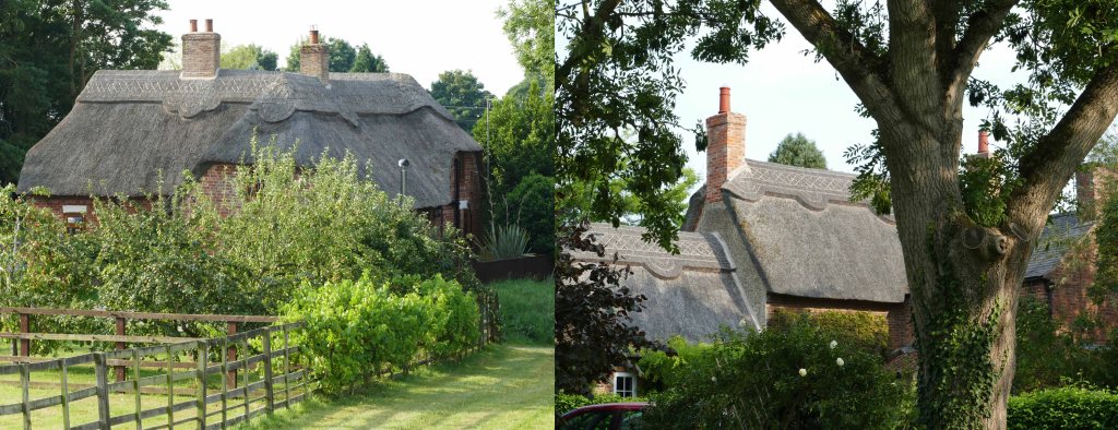
Return to the centre of Mareham village where there is a good track that leads north to High Toynton with its thatched cottages. Here you can return to Hagworthingham by bus or return by foot on the north side of the A 158 making a round walk of about 18 km. This round walk actually circles the highest hill in the area. This is not obvious because it is broad and flat topped. It is 129m high and capped by Round Hills Holt standing close to the A 158.
Whereas the first half of the walk to Toynton was undulating the return to Hagworthingham is essentially climbing and then descending a ridge that is the watershed between the rivers Bain and Lymn. This peaks at 127metres on entering Greetham with low points of about 55 metres south of Toynton and a kilometre short of Hagworthingham.
From a low point south of High Toynton the walk climbs through the village and crosses A 158 to follow Tetford Road out of the village. This road then heads east continuing to climb gradually for over a kilometre. A long uphill climb on tarmac might seem a drag at this point in the walk but it will quickly become more inspiring once reaching the high point of the walk just ahead. This is reached by taking the first possible right onto a narrow lane which offers views back to Mareham on the Hill before leading into the hilltop village of Greetham. At the north end of the village, just past the church, there is a footpath to the right with impressive views across to Warden Hill. This heads east across a field to Greetham Lodge. This house stands on Tetford Road but on reaching the road look immediately for another footpath that continues east to Ashby Puerorum. (See Damp Dale & Ashby Puerorum post.)

This is now Damp Dale across which no road crosses for the next five kilometres despite the dale being overlooked by several small villages. These are mainly connected by tracks and footpaths which gives one the feeling of having discovered a part of the Wolds hardly disturbed since Tennyson’s time. Even the small village of Ashby is a quiet cul de sac well off the beaten track. From its prominent church a footpath leads southwest across the dale to Hagworthingham a couple of kilometres away. Down by the stream, which the path follows for about 300 metres, you feel cut off from the modern world surrounded by hills and woods. This only becomes more pronounced when you cross over the stream and enter Little Dale. When I passed through I found myself following the tracks of a Muntjac and then surprising a large dog fox, which was probably intent on snatching the cock pheasant I had flushed moments earlier.

The climb out of Little Dale back to Hagworthingham is delightful and dealt with in more detail elsewhere. (See Tennyson’s Backyard post.) From initially being enclosed by hills you climb out of this watery dale to where there is a view back across Damp Dale to Ashby church and beyond to Roach Ridge. The footpath reaches the western end of Hagworthingham where a narrow lane rises up to Mount Pleasant farm. The bus stop is not far into the village. From the top of Mount Pleasant hill however there are views right across Lymndale with footpaths that can take you across it via Stainsby or Bag Enderby to Somersby and eventually up onto Warden Hill, which rises behind this village. Here Tennyson spent his youth and must have walked all these paths but that is for another day (See Trails through the Dales post.).

