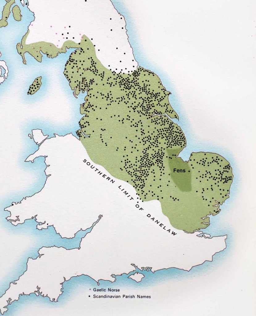
In the introduction to this blog I explained why I used descriptive names like gill and rig, normally associated with northern England, to describe the landscape of the southern Wolds. The first map shows how in the Howardian Hills in North Yorkshire where these words are used within a topography similar in height to the Wolds. On the southern edge of these hills are a line of settlements like Brandsby, Stearsby, Skewsby and Dalby that end in by much the same as you find in Lindsey because both were settled by Danes in the ninth century. Further north in Yorkshire though there was also Norwegian settlement in the tenth century. The influx of Norwegians entering the north from via Dublin and the Irish sea had a destabilising effect on the region giving Yorkshire a much more turbulent tenth century than south of the Humber where Danes predominantly settled.
It was in Lincolnshire where Danes appear to have settled in greatest numbers and this was sometimes done in dense clusters especially along the eastern flank of the Wolds. Although clusters of villages with names ending in by have always been seen as evidence of heavy Danish settlement there are no such dense clusters to be found in Denmark itself with only the island of Oland off the coast of Sweden matching the densities found in Lindsey. The clustering of by names in Lindsey and other parts of England suggest that this was done for strategic reasons and under the direction of warlords. (Other strategic clusters can be found in Germany and Finland.) It is not only their density but also their position along main roads or near natural harbours that indicates that they were planned settlements. In east Lindsey this is evident along the Bluestone Heath Road and around Grimsby. Even the place names themselves are often repetitive with so many Ashby’s and Kirkby’s that they need to have a second name like West Ashby, Ashby by Partney and Ashby cum Fenby to differentiate between them. In the southern Wolds there were four Enderby’s, originally Eindrebi, inspired by one of Odin’s many names. They too had an extra name like Bag and Mavis and two Wood Enderby’s with in time the more eastern changing to Woodthorpe to stop further confusion.

The density of by settlements in the southeast corner of the Wolds either side of the Bluestone Heath Road is more than anywhere else in the British Isles and possibly the World. On the whole the size of parishes are very small but as was highlighted with Calceby (See Calceby & the Domesday Book post.) in the Domesday Book they are often listed in clusters sometimes including settlements quite far away out on the marsh. Also out on the marsh are many place names ending in thorpe. A Danish derived word which indicates a secondary settlement. These settlement patterns are complex but it shows that Danish settlement might have originally been in defensive clusters but later spread out on to more marginal land that had the potential to be improved or even reclaimed.

As the second map shows even deep in the Fens place names with Danish origins pop up. Ferndale House could be a modern name but surprisingly dale does appear in other parts of the Fens as well. Holme was old Danish for island and further north near the mouth of the Humber there are three holmes and a thorpe almost in a line (Keyholme, Wragholme, Grainthorpe and Conisholme). In both of these marginal areas salt production was a lucrative trade for centuries with the spoil dumps creating islands over time. Some parishes grew very large and rich and by the height of the Middle Ages were able to build grand churches that towered above the flatlands. Generally these rich enterprising Fen villages were open parishes, which means they had the advantage of not being dominated by a single lord giving them more freedom in decision making, which was done collectively and sometimes included neighbouring parishes working together in cases of flood prevention.
The third map of the southwest corner of the Wolds is most intriguing. Generally in the Domesday Book (DB) Lindsey parishes were often listed as large and growing. Unlike some other parts of the north and midlands after the Norman invasion the region remained prosperous. This was in stark contrast to much of Yorkshire which had suffered from King William’s Harrying of the North in the winter of 1069 in reprisal for an uprising and sacking of York done with the aid of a Danish Army. Seventeen years later in the year the Domesday Book was compiled much of this county was still described as waste such was the ferocity of William’s reprisal.
During this same winter the Danish army overwintered somewhere in Lindsey. Unlike the earlier Danes this army was sent by the Christian king Sweyn II who had a claim to the English throne as grandson of King Canute (Cnut). The Anglo-Saxon chronicle reported it to be a hard winter and in Spring of 1070 the Danes plundered Ely and Peterborough with the aid of Hereward the Wake. The Danes were paid off by William and set off for home with their booty. It is not reported exactly where they wintered in Lindsey before this but there are clues to where this might have been.

On the map I have highlighted Grebby, Gunby and Orby as well as Castle Hill which was the site of Hanthorpe. All four places were listed as waste in the DB. Gunby is the last hill of the Wolds before the land dips down to the clay marsh and fen. It is close to Croft which is only a few miles to the south and in medieval times was a port. This sheltered harbour is a likely place where the Danish fleet over wintered with the army camping out on the nearest available high ground at Gunby.
This was as safe a place as could be found. The area was densely settled by Danes in the ninth century and in the early eleventh century both Sweyn and Canute’s invading armies were received enthusiastically in Lindsey. This however was two generations earlier and fifty years of relative peace and prosperity had changed the outlook of the early Danish settlers who were now fully integrated into the local economy. This Danish army was now only tolerated rather than welcomed and their hosts were not prepared to risk all they had worked for to join in a rebellion against such a formidable foe as William.

There was nothing they could do though other than accommodate their uninvited Danish brothers over a long hard winter. Not only did the army camp at Gunby and use up the resources of the larger settlement of Orby but they used the timber from Welton Woods near Hanthorpe to build shelters and repair their boats. They also set up two outer camps at high points overlooking roads heading inland along which a Norman army might come. This was at Grebby two miles to the west and near Ulceby, another village listed as wasted in the DB. Like today at Ulceby Cross, but just a few hundred metres further west, this was a main crossroads. It was also a high point at 100 metres above sea level which offered wide views to the north and along the Bluestone Heath ridgeway.
There were also many Danes who had established themselves in Lincoln making it a growing and prosperous town. Before the arrival of the Danes England was a completely agrarian society ruled over by an elite which had become ever more remote over time seemingly preoccupied with the new Christian religion, which consumed more and more of their time and money.
Lincoln was one of the earliest Christian centres in the country with which the local aristocracy were heavily involved when Lindsey was still a semi autonomous region (See Partney and Spilsby post.) but by the ninth century the region was under the rule of Mercia centred far away in Tamworth. When the Danes took over Lindsey, it was once more able to become semi independent but as a Jarldom. This was one of five set up in the north Midlands based in the towns of Derby, Nottingham, Leicester, Stamford and Lincoln and collectively known as the Five Boroughs. There were others more loosely connected further south such as Northampton and Bedford. These boroughs or Jarldoms were sandwiched between the hostile and expansionist kingdom of Wessex and the large and aggressive centre of York ruled by a succession of Norwegian Vikings warlords.
York though prosperous was a very unstable political entity with rulers being replaced, often violently, every few years with no dynasty able to establish itself. Wessex in contrast was ruled by a long established dynasty stretching back well before King Alfred and had consolidated and expanded since the arrival of the Danes. Unfortunately this had caused it to become increasingly centralised and feudal. The freedom enjoyed in the Five Boroughs, which included freedom of worship, must have been irksome to Wessex. Most remarkable though was that it was a confederacy where the Jarls of each borough worked together to try and maintain their independence.
This was a rare thing with only Iceland having anything like it with the island split in four quarters for governance. Even rarer was that in Lincoln coins were minted in the 920s called St. Martin’s coins, which did not include the head of a king or any other ruler. Similar to the ancient Athenian drachma with Athena’s owl symbol. Like Athens Lincoln particularly flourished under an open regime. St. Martin was its patron saint and showed the city to be practising a quiet christianity by this time. With such aggressive neighbours though it was inevitable that one by one the Five Boroughs would succumb to Wessex’s expansionist ambitions with Lincoln the most successful and the last to fall.
Once again Lindsey was being ruled by a distant monarch but when the threat of Viking York had finally been eliminated in 954 there was a period of peace in England during which King Edgar recognised the Danelaw stating “It is my will that all secular rights be in force among the Danes according to as good laws as they can best decide on”. Later Aethelred was not so magnanimous and when Danish attacks started again particularly on Wessex towards the end of the century he persecuted Danes long settled in England and particularly those of Lindsey on ethnic grounds. This only showed up his weakness and encouraged the Danish King Sweyn, whose sister Aethelred had also killed, to take over the country. Sweyn was victorious but soon died and after a struggle his son Cnut went on to rule for 19 years and in total there was 50 years of relative peace until Edward the Confessor died. In this time Lincoln grew and prospered. Churches were built by wealthy merchants but Lindsey remained free of state sponsored monasteries.
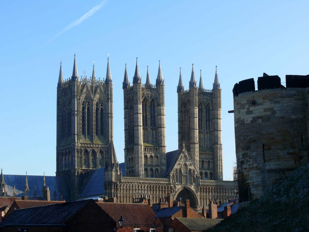
This would all change radically under the stern rule of the Normans. William and his sons were shrewd enough not to interfere with the success of Lincoln and its prosperous hinterland but recognised its importance by building one of the country’s great cathedral’s there. Lincoln at this time reached a population that would not be surpassed until the nineteenth century. The Lindsey Survey of 1115-1118 shows how the region continued to prosper. By the early twelfth century though there was an explosion of reformist monastic institutions in France spearheaded by the Cistercians. They claimed a foothold in England by setting up their first monasteries in a still barren and depopulated north Yorkshire. A long lasting legacy of William’s Harrying of the North in 1069.
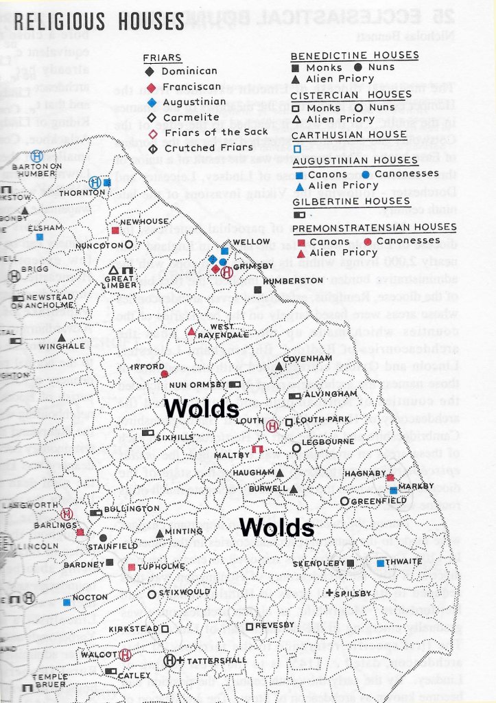
Once established monastic houses rapidly spread across England like a rash and Lindsey was one of their target areas. They took large swathes of land including consuming whole parishes. These monasteries and priories circled the Wolds giving them access to a mix of hill and marsh to exploit and make them rich. The main casualties were the long established free men, descendants of Danes, whose hard work had opened up much of the land in the preceding centuries. (See Greetham post.)
The other impact of the monasteries was the influx of a clerical class who had close ties to the French speaking Normans who found them to be a useful tool to establish a new state order. The relatively few Norman barons who came over with the conquest would have not been sufficient to change the English language but with the aid of this new class of clerics not only was the lifestyle and laws of the Danelaw under threat but also the naturally evolved Germanic language which the inhabitants spoke.
It would not be long before an early form of middle English emerged from out of the monasteries. This coincided with the demise of a free yeomanry centred mainly in the Danelaw so that the whole of England became uniformly in the grip of a fully fledged feudal society ruled directly from the royal capital. The remarkably ambitious experiment of a devolved government set up by the Five Boroughs was now a distant memory as were the freedoms of the Danelaw. The ruling elite would make sure that both would become only frowned upon footnotes in English history. In reality though the common people knew this and the much vaunted Magna Carta was only to secure the nobility’s grip on the land. Only folk memories of semi mythical freedom fighters like Hereward the Wake and Robinhood were passed down through the generations to help keep alive hopes of freedom.
On the continent however a tiny group of fierce and determined communities around Lake Luzern in central Europe kept the faltering flame of liberty in western Europe alive. Their act of defiance against the oppression they endured under remote Austrian dukes led to the emergence of the highly successful and long lasting Swiss Confederacy. In northern Germany also cities prospered as part of the Hanseatic League with merchants having freedoms that their counterparts in England were only able to look on with envy. Cities in Italy were even richer and more influential managing to win and govern independent territories of their own.

England and eventually Britain became a hugely successful nation and while it ruled the waves the inequalities which continued to haunt the nation were largely overlooked. Now that we are free from the responsibilities of trying to run the world, surely now is the time to look back to before the country and its land was kidnapped by a small minority of nobles who distorted the story of this country’s history to their own ends. Making people believe that a highly centralised government was the only option. As seen from the map below the River Humber and its tributaries were central to the economy of the Danelaw. Unlike political entities this remained unaltered for 250 years connecting inland cities to northern Europe before the national focus turned southward. Surely after a thousand years it is time to give the great northern and midland cities the same opportunity of the Five Boroughs to grow and thrive free under the actions of their own political enterprise.