This traverse begins on the Ulceby Chalk Plateau. Apart from said hamlet this 100 metre high plateau for most of history was empty and windswept crossed by a few lonely roads. On old maps it is referred to as the Great Furze meaning mainly gorse scrub. It allowed until Tennyson’s youth for clusters of Stone Age long barrows to survive until modern agricultural methods and heavy-handed early archaeologists damaged or destroyed most of them. Before this time only grazing sheep and burrowing rabbits were a threat. (See The Bluestone Heath Road post.)
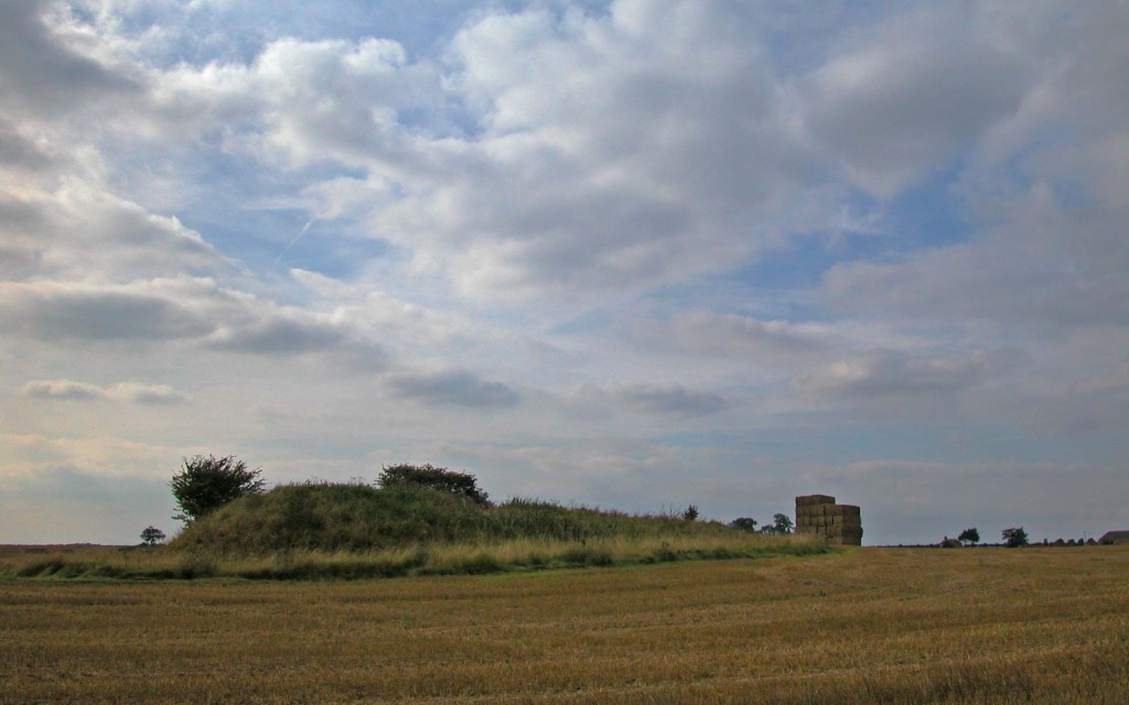
A prominent surviving example is Spellow Hills lying close to the A 16. This large hummocky long barrow has lasted into the twenty-first century where others around it did not. Just a kilometre or so south of this landmark there is a sharp right turn off the main road onto a narrow lane that begins our traverse of Lower Lymndale. This means following this narrow winding lane off the open rolling chalk plateau and plunging down the steep scarp slope clad in trees into the scattered hamlet of Langton below. The village stands on a lower sandstone plateau in the shelter of the chalk topped escarpment. North of the village the scarp slope is more open and here are a series of prominent spurs covered in rare natural dry meadow yet to the south of the village an indentation in Langton Edge accommodates the wet wood of Callow Carr illustrating the complex geology of the scarp slope which incorporates several contrasting bands of rock. At around fifty metres asl is a band of rock called the Tealby Formations made up of clay and mudstone and is responsible for the damp conditions of Callow Carr and the stream that runs through it. This band of rock continues north near the base of the scarp slope and is responsible for all the tributary streams of Langton Beck and other wet woodlands like Northdale Carr and Pitchmoor Plantation. The same strata continues along the base of Brinkhill Rigg all the way to the flanks of Ketland Hill where the source of Langton Beck can be found.
Meanwhile, the attractive village of Langton, spaced among trees, its place on a dry sandstone plateau is in common with many other small settlements in Lower Lymndale, with these well-drained soils having definitely been the preferred sites for communities to settle at least as far back to Roman times. The brick Georgian parish church however is perched on the edge of the plateau overlooking Langton Beck, which at one point is referred to as Skir Beck. Skir is an old Danish word meaning clear or bright and refers to the beck’s clear waters that have mainly seeped through the chalk to emerge partway down the scarp slope and merge to form the beck as described above. This is one of the River Lymn’s longer tributaries and contrasts with nearly all its others which originate from darker rocks and have darker waters.
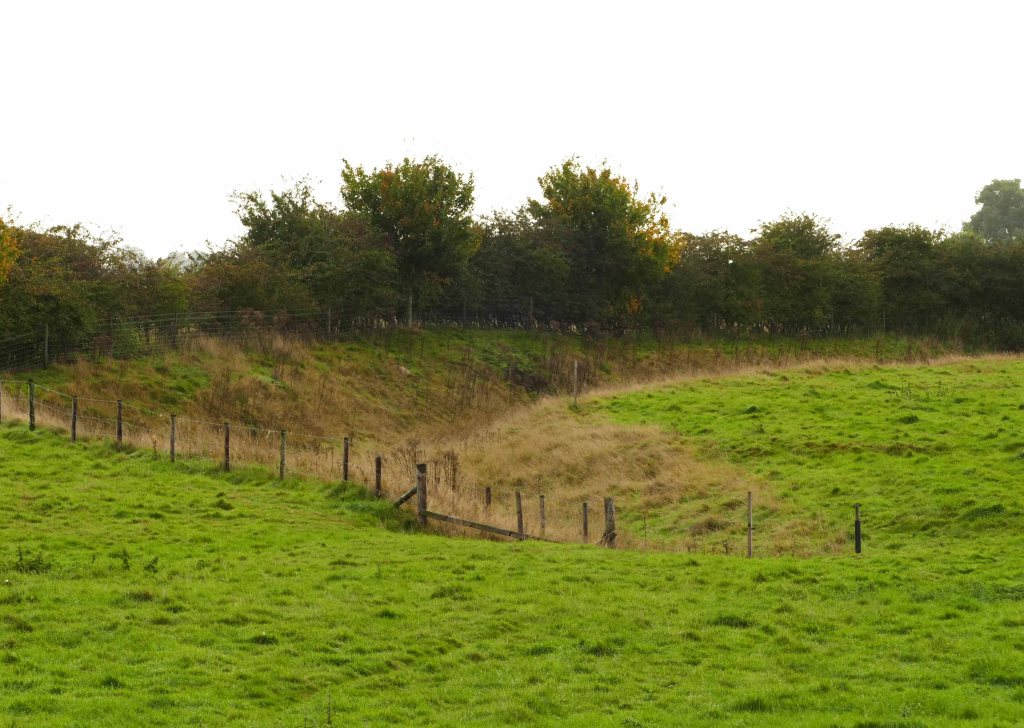
200 metres south of the church are the remains of a medieval earthwork, which a footpath crosses and passes close by Church Carr which itself runs alongside the beck. The footpath carries straight on to Hop Carr. This wood fills a dip in the land along with a small stream that flows at right angles into Langton Beck. It reveals though how thin the sandstone is at this point and shows its limit coincides with the 25 metre contour. This corresponds with the positioning of the earthwork which was once a medieval moat. This was originally cut deep enough to pass through the thin sandstone to the base clay making it watertight and was fed with water from the beck. This suggests that water levels were higher back then which has been confirmed by recent archeological excavations when the Partney bypass was built just two kilometres downstream.
The land between the wet woodlands along the beck and those on the steep face of the scarp slope is all arable fields connected only by a belt of trees along the lane that passes through the shrunken village which centuries ago was bigger and busier when this lane was a main artery across the Wolds. (See Langton Old Road post.)

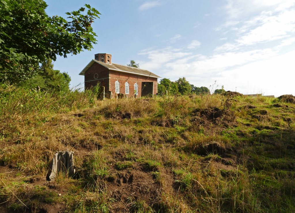
This lane leaves the village by dipping down past the church with the route then heading for Aswardby. This tiny hamlet is mostly hidden away from the road but from crop marks in the surrounding fields there is plenty of evidence from aerial photography that here in Roman times was the largest of several settlements in Lymndale at this time. It is here that we leave the tarmac behind and set out across the dale on foot. This is done by following a cul de sac lane that passes between the commodious hall and the diminutive church. The miss-match of these two contrasting buildings graphically illustrates how by the late Victorian era landowners had become very wealthy and many peasants had left the land to find factory jobs. Those that remained probably preferred to go to services in the hamlet’s Methodist chapel.
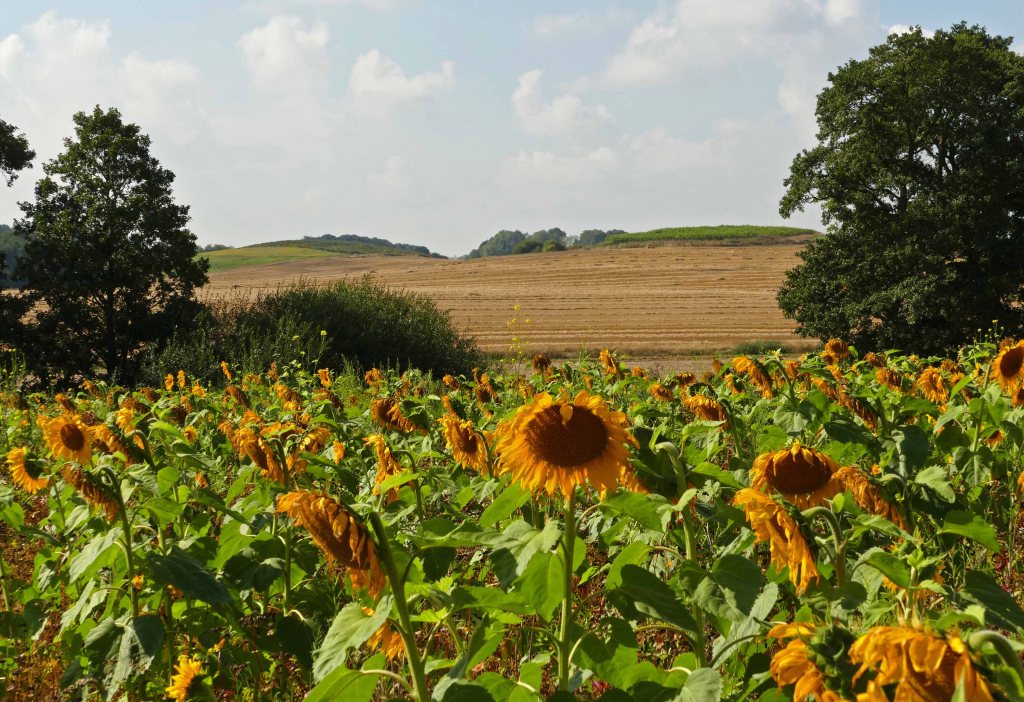
Leaving Aswardby and heading west past a couple of estate cottages the footpath emerges onto open fields with broad views south across Lymndale. The footpath follows the south side of a thick hedge that marks the boundary between the sandstone plateau and the damper clay of the dale bottom. After crossing a ditch the path heads towards the river. When I passed this way in mid-September it was through a field of sunflowers at full height and in full bloom. The air was alive with pollinating insects taking advantage not just of the sunflowers but the understorey of flowering annuals that had been allowed to grow between their tall stems.

The sunflowers had grown tall in damp alluvial soils close to the river. Just a short distance upstream is Stockwith Mill. Downstream from the mill, the valley widens gradually into a wide floodplain but upstream from it, the river has been confined within a narrow trench-like valley that had been cut through the sandstone plateau by glacial floodwaters during the last glacial maximum. (See Lower Lymndale post.) The section of the dale we cross though is much more open with large fields and minimal hedging. When I crossed the river it was still fairly narrow but deep and to my great surprise I spotted a young mink swimming along it.
From the river, after crossing the floodplain at just 25 metres asl (above sea level), the path climbs steadily back onto the sandstone but here the band of rock is fragmented and at first only present on isolated hilltops separated by narrow damp valleys. These knolls are a feature of Lymndale and continue on this side of the river upstream as far as Somersby and are even described in Tennyson’s famous poem In Memoriam AHH. The path levels off on approaching Hagworthingham as the isolated outcrops of sandstone have come together to form a heavily dissected ridge capped with Claxby Ironstone. The village is strung out along the ridge and also along the broad A 158 coast road that bisects it.
After the quiet of the dale, the busy road comes as some surprise, although the noise from it had been building for some time. This section of road marks the southern boundary of the Lincolnshire Wolds AONB but paradoxically the walk that we are about to follow beyond this somewhat arbitrary boundary is through some of the most attractive and unspoiled scenery in the Wolds. Beforehand though it should be said that the village has a couple of eateries in the form of a pub and cafe and a bus stop. This can be useful when planning walks along the many footpaths that radiate out of the village. For example, there is a footpath that will ultimately take you to Spilsby from where it is possible to return to Hagworthingham on the bus. Other paths take you directly to the Tennyson villages of Somersby and Bag Enderby by a much shorter route than the road. By foot they are only a few kilometres distant and can form part of a convenient round walk. (See Round Routes post.)
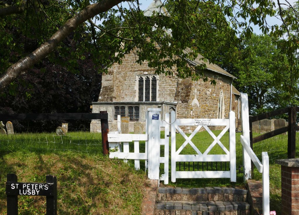
The attractive part of Hagworthingham, however, is found away from the road on its south side with the parish church on its western edge. Surprisingly this is the only greenstone church we pass and looks small and stunted having lost its tower in 1972 when it collapsed. It is however a good example of how the local sandstone weathers to look green especially in winter and on north-facing walls. Neighbouring villages have better examples though, Ashby is larger and Lusby more ancient.
From the church a narrow lane sweeps down to a ford. Across the stream is access to footpaths on either side of the road. The eastern (left) option takes you along the stream through the small nature reserve of Furze Hill but our route heads west following the beck upstream all the way to Snipe Dales Country Park. The beck is hidden from view for most of the way but is audible at times as it tumbles over the roots of alder trees lining its banks and is accessible where it passes under large, wide-spreading beech trees.
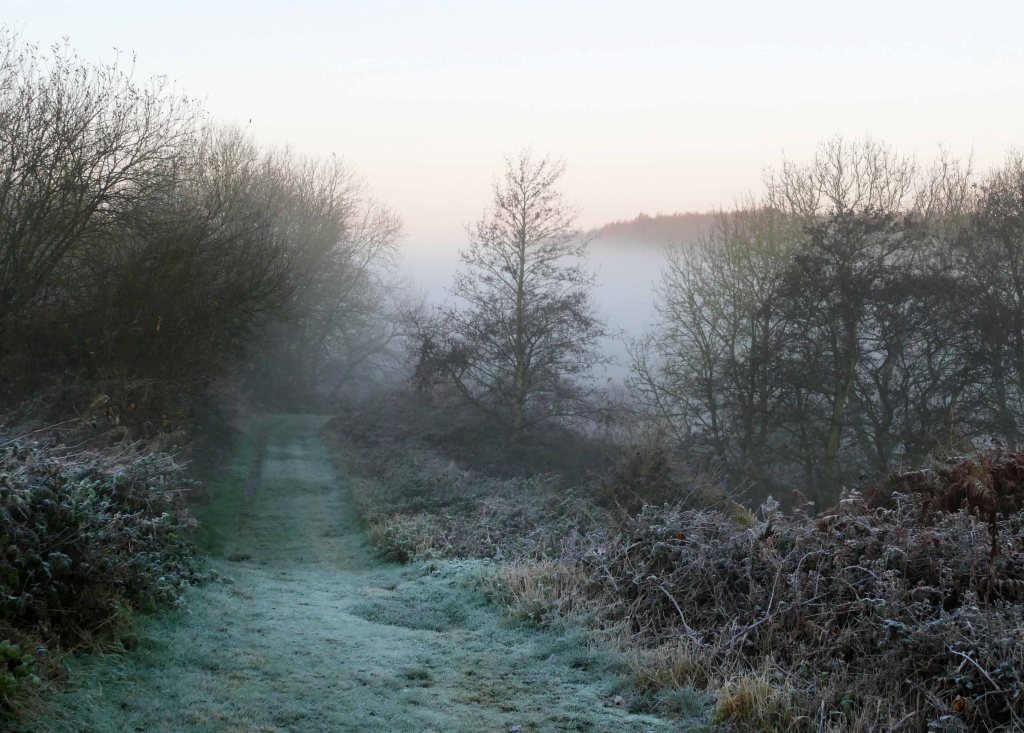
The country park is mostly wooded and occupies a small tributary valley and an adjacent spur of high ground. Beyond however is the Lincolnshire Wildlife Trust’s nature reserve, although much of the valley we have already passed through is also managed by them. The reserve is more open with the aim of maintaining a semi-natural environment that goes back centuries and was once much more prevalent in this area of the Wolds. It is interesting in all seasons but can be most appealing in autumn because this deep sheltered valley gathers cold air at night and helps to form mist over the pale grasses and hoar frost on the russet autumn bracken. A classic frost hollow that is rare in breezy, open Lincolnshire. (See A White Snipe Dales post.)
At the far end of the reserve a path climbs out the deep dale and at 115 metres asl enters an overgrown churchyard of the tiny hamlet of Winceby. Unfortunately, the actual church has been long gone but the future of the graves is assured by being within the nature reserve. Just ahead is the B 1195 which marks the end of our traverse across Lower Lymndale as the road follows the ridge along the dale’s southern watershed all the way to Spilsby. This ridge of sandstone capped in places with Claxby Ironstone is the final ridge of the Wolds. At this point, it is high and narrow but further east it lessens in height but splays out over a wider area where it is incised by a number of short deep valleys each of which was probably similar in appearance, in Tennyson’s time. to how Snipe Dales nature reserve is now. A couple have protection but it is an area of the Wolds which is often overlooked and undervalued and should have more protection and help to manage and safeguard its natural beauty.

