Carr is wet woodland that was mainly concentrated around the edge of the Fens and low lying valleys such as the Vale of Ancholme. Nearly all this woodland has gone although there are two small remnant carrs north of Tattershall managed by the Woodland Trust, although the general drainage of the area has dropped the water table and dried them out somewhat. They stand on Kimmeridge Clay which is also found along the valley bottoms of the southern Wolds. These valleys are fed by countless springs and small streams and because of the impervious nature of the clay are constantly wet. This is in contrast with the surrounding plateau which is on porous sandstone. The clay valleys are narrow and not conducive to modern farming methods and in some places remain as wet pasture and woodland or carr. They are many but are often isolated from one another but they are important islands of wetland habitat in a sea of modern intensive farming. It is important that these Carr Dales are recognised and where possible protected.
Lymndale broadly corresponds with Tennyson Country but is a slightly larger area covering the whole catchment of the River Lymn within the Wolds but in the case of the area which covers all the Carr Dales of the Wolds you have to include the whole fretted sandstone landscape of the southern Wolds right down to the Fens. It is best to take Gravel Pit Hill, a kilometre east of Hagworthingham as a central point and draw a circle with a radius of roughly five kilometres to encompass this whole area. The hill is not high at 73m asl (above mean sea level)) or picturesque because the A 158 coast road passes right over it taking thousands of trippers to the delights of the Lincolnshire coast around Skegness on summer weekends so it is preferable to visit midweek or in winter.
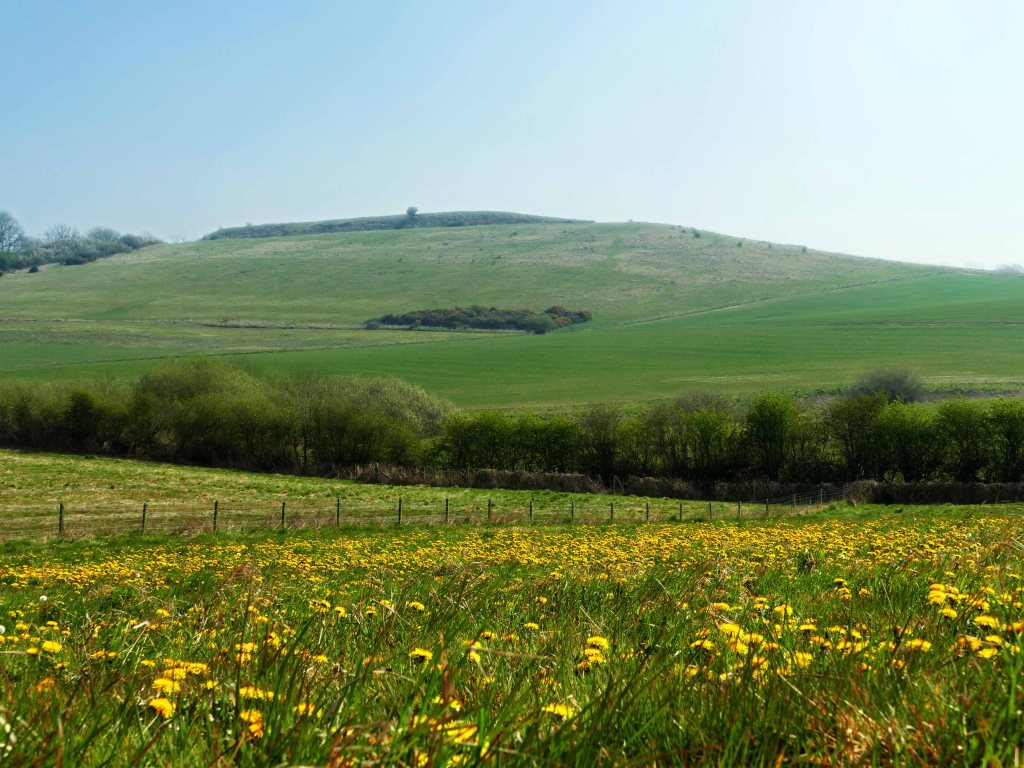
If one does choose to stop here briefly (There is a small layby.) you will see higher hills in every direction. In three directions these hills mark the limit of the sandstone plateau that occupies much of Lymndale. To the west beyond Hagworthingham is Roach Ridge which is capped with Claxby Ironstone to the south rising to a high point of Roach Stone further north. Panning clockwise there is a view of distant Park Hill, which is of similar height to Roach Ridge and made up of similar rocks but is a lot narrower. Following this is the beginning of the chalk escarpment which dominates the northern horizon although all hills so far mentioned are similar in height topping out at about 140 metres above mean sea level (asl). There is a break in the escarpment which is not visible and then continues east as Brinkhill Rigg before turning south as Langton Edge. Although this latter section of the chalk escarpment reaches only 100 metres asl it looks more dramatic. This is because it is somewhat closer but also that the River Lymn at the foot of Gravel Pit Hill is now only 25 metres asl and the scarp slope of Langton Edge is very steep and wooded. (The headwaters of the River Lymn coalesce at 60 metres asl about a mile west of Tetford.)
Although not visible, at Dalby the land descends down to the River Lymn. The wooded hamlet stands on a ledge protruding out from the otherwise steep scarp slope. This is a mile long ridge of Roach Stone at about 55 metres asl and carries the A 16 on a less steep route down the scarp slope to Langton Beck. The beck flows past Partney where it is now only 15 metres asl with the River Lymn just beyond it a few hundred metres away. The two eventually merge after flowing roughly parallel for about a mile This spur of Roach Stone is significant in that it helps to enclose Lymndale in Tennyson’s “Circle of Hills” leaving only a mile wide valley before rising up again to a less dramatic sandstone ridge on which the market town of Spilsby stands. At Spilsby the ridge is only 50 metres asl but steadily rises as one continues to pan clockwise around to the southern horizon where it reaches 100 metres asl at Lusby; a hillside hamlet just a couple of miles distant to the southwest from our observation point. The top of the ridge between Lusby and Asgarby is capped by Claxby Ironstone and completes the 360 degrees pan.
This mix of relatively hard and soft geological strata makes for an interesting and mixed topography with the chalk escarpment the youngest and highest band but with many of the prominent hills overlooking Lymndale topped with Roach Stone but within the dale the most prominent is Warden Hill, overlooking Tennyson’s Somersby, which is topped with a rare band of Red Chalk that stretches east for three kilometres. This complex layer cake of porous and non-porous strata creates probably the most interesting and varied topography east of the M1 motorway

The River Lymn is contained within two ridges. Roach Ridge to the west which curves round at Asgarby to continue as a lower sandstone ridge to Spilsby and the long chalk topped escarpment to the north, which after a break at Harden’s Gap eventually veers south to Partney. Between the chalk and sandstone lie a number of other geological beds. There is a prominent band of Roach Stone that forms the base of outliers extending from the main chalk scarp, which are often capped with Carstone. All these strata tilt down from southwest to northeast so that the Roach Stone at Fulletby is 130 metres asl but by the time it outcrops at Gunby is 100 metres lower. Below it are the Tealby Formations which in this area are mainly clays and mudstones. This layer of strata is responsible for the many streams which issue from the ground where it forms an impervious layer on both sides of Lymndale. Along Roach Ridge this is at a height of around 100 metres asl while across the dale around Langton it is close to the fifty metre contour.

The most widespread bed of rock in the dale is Spilsby sandstone which although only a few tens of metres thick forms a plateau in the midsection of the dale. Still relatively thin and easily eroded, it has been heavily dissected by streams and cut in two by the River Lymn. The final and lowest level of strata is Kimmeridge Clay which is found along much of the course of the River Lymn as well as most of its tributary valleys. The clay is impervious and responsible for many more streams beginning close to its boundary with the highly porous sandstone above, particularly south of the A 158. It is also at this juncture between these contrasting beds that many of the dale’s carrs are found although along Langton Edge others are found in association with the Tealby Formations.
Geological Strata from north to south but tilting down SW to NE.
- CHALK – Along Bluestone Heath Road including Tetford, Dog and Keal Hills. Also topping Brinkhill and Langton Edge.
- RED CHALK – Warden, Cloven and Red Hills. Also mid-height in the scarp slope to the north. Disappears east of Driby Fault.
- CARSTONE – Tops of Park, Nab, Flint and Glebe Hills. Also hills around Brinkhill.
- ROACH FORMATIONS – The slopes of the named Carstone hills plus Stained, Catcliffe, Hoe, Anderson, Ketland and Dalby Hills. Further east the higher ground on which the villages of Scemby, Candlesby and Gunby stand. Its eastern extreme is at Gunby where the stone surfaces at 30 m. asl, whereas at the western end of its range at Fulletby it is 100 m. higher.
- TEALBY FORMATIONS – Mostly found north of the A 158 and most prevalent around the base of Park Hill. Also responsible for most of the tributaries that make up Langton Beck.
- CLAXBY IRONSTONE – Capping the ridge south of Fulletby to Greetham and Asgarby. Mount Pleasant, Thornbury and Gravelpit Hills around Hagworthingham. Sometimes mixed with Tealby Formations as is also the case at Raithby Hill and Mardon Hill.
- SPILSBY SANDSTONE – A plateau on which most villages stand from Belchord to Tetford and south either side of the River Lymn including Somersby, Bag Enderby, Stainsby, Ashby, Aswardby, Langton and Sausthorpe. Also the Spilsby Ridge along which are many other villages and hamlets. It stretches as far east as Halton Holegate and south to Toynton All Saints.
- KIMMERIDGE CLAY – This lowest and softest stratum is found in valleys south of Salmonby, east of Greetham and in Snipe Dales, and all along the valley bottom of the River Lymn and its many tributaries. Also the valleys around Old Bolingbroke.
- GLACIAL DRIFT – A mostly thin veneer of mixed soil and stones often found on both the eastern and western flanks of the Wolds as well as on some hill tops. The eastern till is from the last glacial maximum while further west it is from an earlier glaciation.