The Lincolnshire Wildlife Trust states in their Winter 2021 Lapwings magazine :
“Bigger, more robust, nature reserves will be better able to withstand the effects of climate change and if we can link them into a coherent network, we will allow species to move across the landscape better and prevent fragmentation and isolation of vulnerable bird populations.”
Lincolnshire covers an area of 690,000 hectares. This figure presumably just includes land inside the sea wall, which stretches from Gainsborough on the Trent all the way round to Sutton Bridge on the Nene. There are large areas of land beyond the wall but these can be covered by the biggest spring tides though they do include large areas of untamed land important to wildlife. The old kingdom of Lindsey accounts for well over half of the total area of Lincolnshire, most of its coastline and all the Wolds and as such has the most natural interest for visitors to the county.
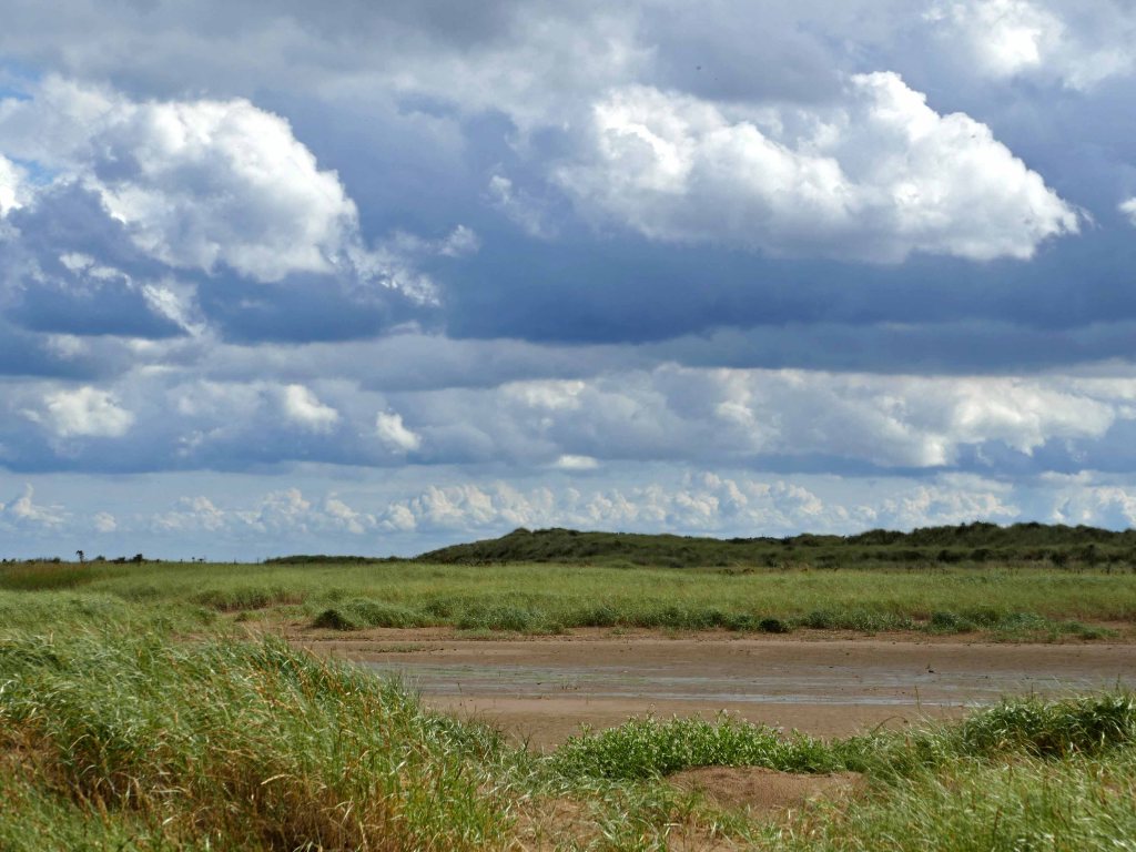
There are nearly a hundred nature reserves in Lincolnshire owned or managed by the Lincolnshire Wildlife Trust (LWT) and several others run by different organisations but there is no land, other than that around the estates they run, owned by the National Trust. By far the biggest wildlife refuges are along the coast (beyond the wall) with Donna Nook at 1150 hectares, easily the largest. Inland the reserves are much smaller with most less than 100 hectares and many a lot less than this. In the Wolds Area of Outstanding Natural Beauty (AONB), considered by many as the county’s rural heart, there are only a few. Though both east and west of this high ground are several woods and areas of heathland which are protected.
Two other large coastal reserves are Saltfleetby and Theddlethorpe Dunes (556 hectares) and Gibraltar Point (437 hectares,) both happen to be at a distance of 25 kilometres from Hagworthingham on the southern edge of the Wolds AONB and close to the popular nature reserve and country park of Snipe Dales. Promoting these three reserves together would give a more balanced view of what East Lindsey has to offer visitors especially if there was an ambition to extend Snipe Dales further downstream as described below. Such a thing has already been achieved along the Norfolk Coast and the Holkham Estate.
Some might say that the Lincolnshire coast cannot compete with that of Norfolk’s for natural beauty and wildlife spectacle but then Norfolk has nothing to compare with the designated upland landscape of the Lincolnshire Wolds. The main problem though is that Snipe Dales, which is the biggest reserve in the Wolds (though just outside the AONB), is only 87 Hectares, about half the size of Whisby near Lincoln, the trust’s other popular inland reserve.
There are other anomalies such as the home of Tennyson for the first 28 years of his life not having a visitor centre in contrast to virtually every other major nineteenth century poet. Another omission by the National Trust. This may not be appropriate in his birthplace. The hamlet of Somersby is still a rural idyll served only by narrow winding lanes but there are other bigger and more accessible villages nearby like Hagworthingham and Tetford that are within walking distance that have facilities.
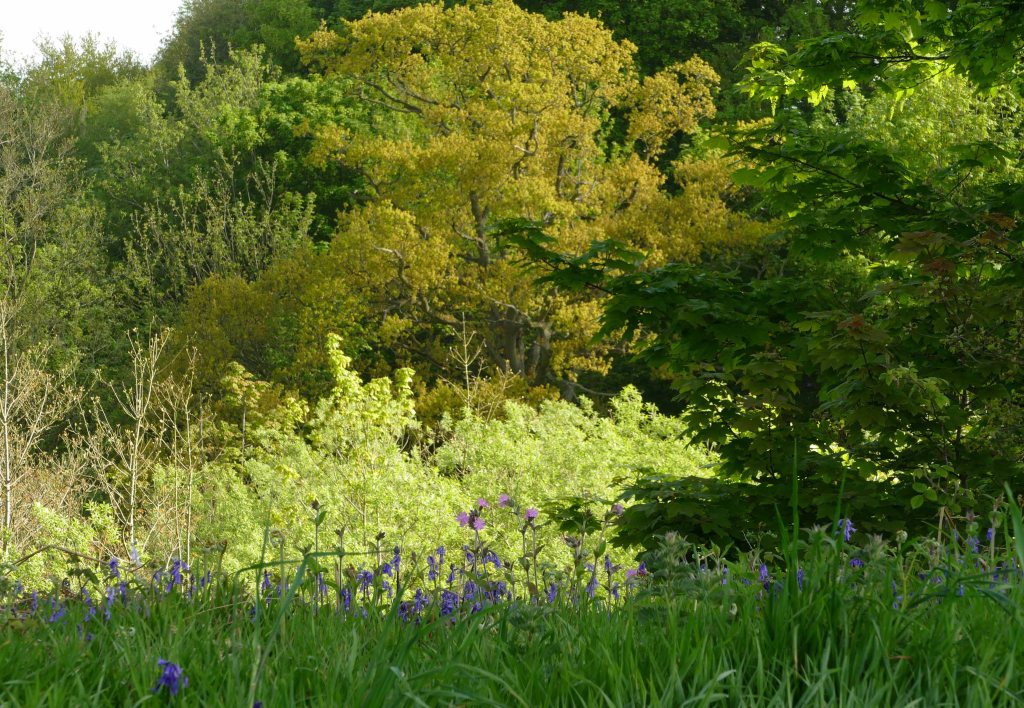
The other point to make is that the land around Somersby and particularly immediately to the west of the village is some of the most geologically varied in the county and is responsible for a wide range of habitats (See After the Rains post.) that inspired Tennyson during his formative years, which is why Tennyson Country is almost synonymous with Lymndale. The lane from St. Margaret’s church with its slender elms west across Tennyson’s Twin Bridges (See Feature Image) to Old Woman’s Holt, containing large teetering willows, is virtually a roadside arboretum of mostly native trees and the land around it encompasses some exceptional landscapes for this part of the world such as the New England Ravine and Tennyson’s Knolls. The area that covers all these features is marked out on the accompanying map and covers an area of about eighty hectares, or similar to some of the larger woodland reserves peripheral to the Wolds but which have less overall interest and diversity.

This geodiversity, which is responsible for it, is some of the most complex and varied not just in Lincolnshire but also most of the counties surrounding it. It is made up of a layer cake of strata of porous and impervious layers of hard and soft rocks of varying thickness. Added to this the morphology of the area was significantly affected at the peak of the last glacial maximum (LGM) to the extent that the River Lymn was forced to cut a new more southerly course which it still occupies to this day. (See Geology of Lymndale post.)
Snipe Dales, Snakeholes Dale and the New England Ravine are just three examples of Carr Dales. There are many others in the south Wolds that are listed below with their differing dimensions and together they form a network of wild wet areas mostly within the catchment of the River Lymn but also some other streams that flow south into East Fen. All are contenders for some form of protection or grants to help preserve them because together they form a potential network of wildlife corridors. As most obviously in Snipe Dales but also in many others the snipe, that most emblematic bird of the wet pasture and woodlands, was once resident in these Carr Dales but like many species is now rare. It would be good to help bring back such species, possibly even the elusive woodcock that may appear if circumstances become more favourable.
Five kilometres south of the A158 and well outside the Lincolnshire Wolds AONB is the LWT nature reserve of Keal Carr which has the classic profile of a Carr Dale. (See Keal Carr post.) This is the last dale to use of the word carr in the Wolds before it meets the Fens. The most northerly carrs in the Wolds are to be found in the deep valley of Ketsby Beck on the far side of Tetford Hill. North and east of this valley the character of the land changes to be made up predominantly of chalk where villages incorporating the word “well” proliferate. This is a reference to water as in a spring or pond which becomes more scarce the further north you go on the chalk wolds. This is not a problem heading south where Spilsby sandstone predominates.

The mean level of this stratum is about 50 metres above mean sea level (asl) which coincides with much of the sandstone plateau overlooking the River Lymn and its tributaries. This contour has been picked out on the map included. Beneath the dry sandstone on which most of the villages stand is wet clay. Although quiet today there is plenty of evidence from aerial surveys to show that the plateau has been well populated right back to Roman times and probably even before. The intervening valleys were never settled and except for a few disused water mills were always corridors for wildlife until interrupted by roads crossing them. The boundary between the two strata is where many streams issue from the ground and it is here where most carrs are to be found. These havens for wildlife are sometimes named on the map but their actual number is more than double this and include the holts and coverts north of Mavis Enderby for example.
A thousand years ago, when this area was one of the most heavily populated places not just in Lincolnshire but across the MIdlands, the fragmented landscape was then an advantage as landholdings were also fragmented. This was deliberate so that communities had access to a diversity of land to meet all their needs. Generally, it was sheep on the hills, crops on the plateau and cattle in the valleys plus plenty of managed woodland close at hand. By the time Tennyson was a boy this traditional type of farming was changing (much alluded to by the poet John Clare) to increase production to feed a fast growing population and by the mid-twentieth century mechanisation brought the need for even larger farms and fields.
Today the Carr Dales have become awkward relic areas of small fields and woods that are unsuitable for the large-scale farming found in the rest of Lincolnshire and should be converted to other uses, principally to encourage natural diversity. Stakeholders of the Carr Dales should be encouraged to improve the connectivity between these wet valleys to form a whole network of wildlife corridors across Lower Lymndale. (See Gone is All the land in flower squares post.)
It is fortunate that some of these wild and wet Carr Dales have survived as wildlife havens adding character to the landscape. They are often connected by streams occupying valleys too wet to cultivate, allowing more diverse flora to survive and already offer some shelter to wildlife. A few carrs and the odd valley are protected as reserves or SSSIs but this network of woods and streams should be looked at as a whole and be managed sensitively, from Salmonby Carr in the north to Keal Carr, which would help preserve such a diverse area set in an otherwise monotonously and intensively farmed county.

Instead of the current piecemeal approach to nature conservation in the southern Lincolnshire Wolds with isolated reserves and SSSIs there should be a strategic approach based on returning to something like the wealth and diversity of wildlife in the area that Alfred Lord Tennyson knew well and was able to enjoy during his formative years and often alluded to in his poetry. Even Holywell Wood, a wet woodland just 400 metres north of his home, was for a few years the place where he and his brothers were schooled but it was the whole of Lymndale that inspired much of his later work. If the bard was able to return to his home today he would find much very familiar to him but then he would become aware of the lack of noise from the loss of insect life and the many birds that have now gone. Even the noise of people, especially children, would be missing, replaced by the sounds of machines. Missing too would be the many trodden paths through Tennyson’s “ flowery fields” that were once used to get to church, the watermill or to work in the fields. Everything today would look neater and more tended than he would have been used to, like verges mown along dung free tarmac roads and arable fields without a weed to be seen. Generally, all natural life has become pared down to the most efficient essential of getting maximum return from the land.
To reverse this loss of wildlife habitats and to return the rights of way that have also disappeared would require a change in farming practices. The country’s second largest county, in spite of being largely rural lacks large inland areas of uncultivated land attractive to both people and wildlife. A protected area of a more intimate landscape of hills, hedges and woods away from the exposed coastline and bare windswept arable acres stretching off to the horizon would be appealing to all life. The sheltered woods and dales of Lymndale would offer an all year round alternative destination away from Lincolnshire’s other large nature reserves strung out along its long but bracing coastline and offer sanctuary to man and beast when the cold winds blow off the North Sea.

An interesting precedent regarding habitat preservation locally is the Lincolnshire Limewoods which about twenty years ago were recognised as rare and important on a national scale after a century of being forgotten and unloved. Since then there has been an encouraging turnaround bringing local landowners on board with the planting of hedges and new blocks of woodland together with an awareness of the uniqueness of limewoods which create light woodland encouraging understorey species to thrive.
The designated area of limewoods east of Lincoln is similar in size to that of the Carr Dales east of Horncastle. However, whereas the replanting of woods is in blocks, the restoring of the Carr Dales is linear. This means that providing suitable habitats to create greater connectivity requires far fewer acres/hectares. The chart shows that many of the Carr Dales are in the region of two hundred metres wide with some only a hundred metres, which in terms of area adds up to only ten hectares over a distance of 500 metres and a kilometre respectively. As with the limewoods, the boundary between bare open fields and a secluded habitat beneficial to wildlife is stark. Therefore the creation of a network of wildlife corridors over quite a broad area not only requires relatively few hectares with much of this is damp or rugged land not suitable for modern agricultural practices.
The Length and Breadth of Carrs in the South Wolds.
| 400m | x | x | |||
| 300m | |||||
| x | x | x | |||
| 200m | x | x | x | ||
| x | x xx | x x | |||
| 100m | x | xx x x | |||
| 50m | x x | ||||
| 0m | 500m | 1000m | 1500m | 2000m | 2500m |
Carrs grouped in width bands – shortest to longest.
50m. Hop Carr, Church Carr
100m. Fairy Wood, Simon’s Holt, Harrington Plantation, Little Dale, Periwinkle Holt, Nine Pound Hole.
150m. Wetherton Hill Wood, Harrington Carr, Cliff Carr, Cinder Hill Carr, Salmonby Carr
200m. Wheelabout Wood, Keal Carr, New England Ravine
250m. Callow Carr, Snake Holes Dale, Snipe Dales
400m. Mavis Enderby Dale, Sow Dale
Looking at the chart again, generally speaking, the Carr Dales are narrowest in the north and widest in the south. To the north the land is higher and the geology more varied. Added to this it has been modified by meltwater channels from the last glaciation particularly close to Tennyson’s home of Somersby where the River Lymn meets its first significant tributary. As described in previous posts this is perhaps one of the best places in the Wolds for mixed woodland habitat and is a contender with its associations with Tennyson for some kind of protected status. (See After the Rains post.) A similar argument could also be made for the upper catchment of Salmonby Beck around Hoe Hill, as I described in the previous post, for protecting its varied landscape and geology.
Despite the attractions of these two areas it has to be said that the main contender for serious protection as a pilot area for reverting back to less intensive farming practices and limited fertiliser management that are more in harmony with nature (and to make up for being outside the AONB) is the dale immediately south of Hagworthingham. The big advantage here is that the upper reaches of this dale is already a nature reserve. This reserve, the adjacent country park of Snipe Dales and even sections of the dale further downstream are already managed by the Lincolnshire Wildlife Trust. However, this management would be best allowed to extend further east still to the floodplain of the River Lymn.

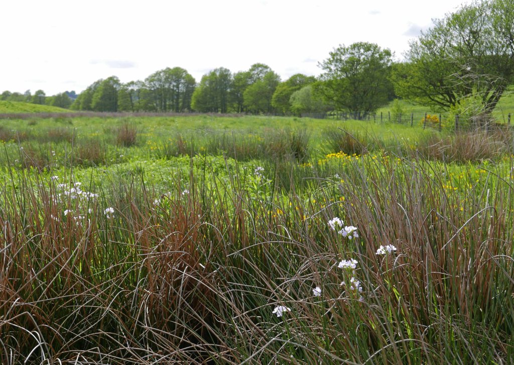
Snipe Dales Beck descends swiftly for its first two kilometres, from its source at 100 m. asl flowing swiftly between steep-sided hills. By Raithby Bridge it is below 30m. asl and slows right down as it enters the flood plain of the River Lymn. A hundred years ago this was as a series of meanders but today both the river and its tributary have been straightened and constrained. It would be good if the beck’s final kilometre and a kilometre of the River Lymn downstream from Aswardby Mill were once again set free to become a natural floodplain. To quote Tennyson “ Nor pastoral rivulet that swerves To left and right thro’ meadowy curves,” (In Memoriam AHH.)
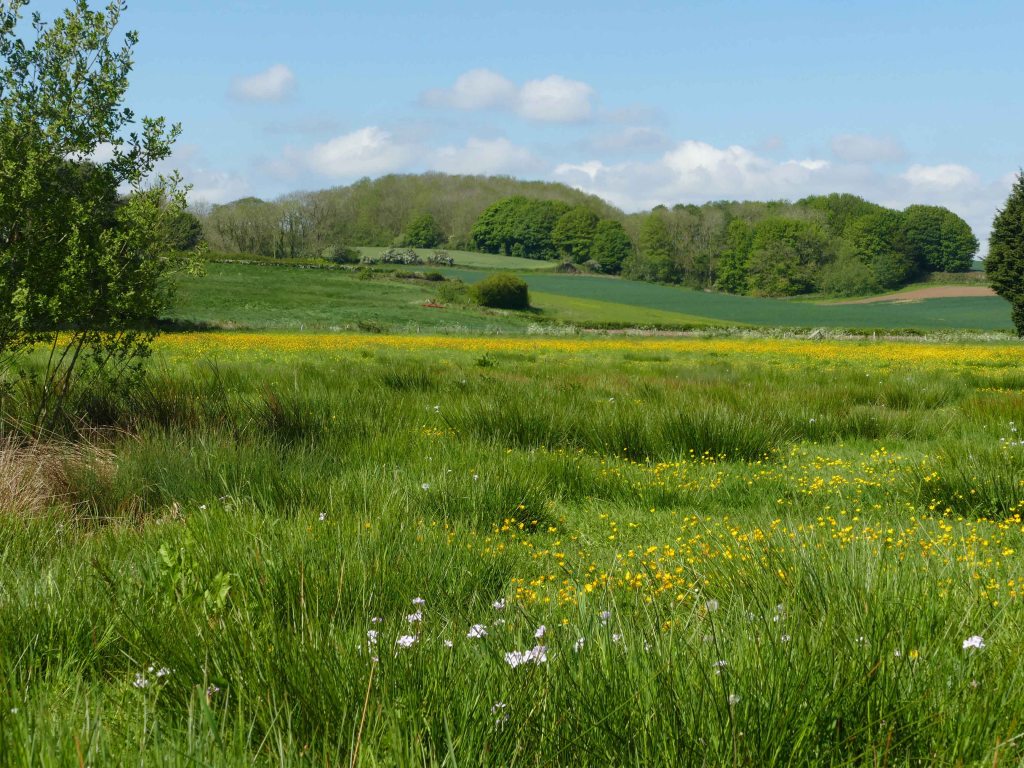
This would be a return to permanent pasture and allowing temporary winter flooding to restore a wetland habitat so the land could revert back to what for this area is a rare lowland meadow and both beck and river are set free to meander freely as Tennyson observed. Currently this type of management scheme, known as Making Space for Water, is eligible for £640 per hectare for 20 years. As well as improving water purity this would have the important extra benefit of acting as a natural overflow area that would prevent flooding downstream during times of excessive rainfall as happened in June 2019 around Wainfleet.

Just before Raithby Bridge, Snipe Dales Beck is joined by water flowing down through Milelong Dale from Mavis Enderby through a rugged landscape of mixed land use which includes a number of SSSI woods. By including this tributary it would create a single natural hydrological unit to ensure that most of the catchment area of this already partly protected beck would be free from agricultural pollution and provide protection to a wide variety of wildlife and habitat. The proposed protected area marked out on the map includes all three areas (Snipe Dales Beck, Milelong Beck and the Lymn Floodplain.) and extends seven kilometres but because of its linear nature covers a total of only 230 hectares with an altitude drop of 100 metres. This relatively small area would include dry hilltop grassland, damp valley floors and potentially floodplain meadows. All this also has the benefit of lying upstream from the River Lymn’s main abstraction point at Partney Mill.

It is two hundred years since a young Alfred Tennyson explored the hills and dales around his home. It was a safe environment managed carefully by humans for centuries but where a healthy diversity of wildlife could also exist. Not many miles south are the Fens and not many years before Alfred was born these were still referred to as the wild Fens, a maze of waterways hidden among tall reeds that was home to massive flocks of wildfowl and water alive with eels and large shoals of fish which today is difficult to comprehend. Even in Alfred’s time they were drained but not tamed prone to flooding every winter. The Fens today could not be more different and in common with much of the county harnessed by man to be worked for maximum productivity. To reverse this would require a complete turnaround in what we regard as important. A choice between human domination or some attempt at harmony with nature?
The changes that have taken place in Tennyson’s Lymndale have been much less extreme over the last two centuries but wildlife, especially its diversity, has still suffered badly. To redeem this though would not mean such a drastic turn around as in the Fens, only a more sensitive approach to how the land is managed by scaling back the chemical warfare we have waged against wildlife in the last few score years. The streams, woods and most hedges still remain and a number of lakes have been added. It is mainly the pasture and meadows that need restoring to how they were and establishing some strategic wildlife corridors to give locally endangered species a chance to recover and for lost species to return.
Other posts which include more detail to specific areas.
Gone is “All the land in flowery squares”.
After the Rains
Old Bolingbroke
Keal Carr, a hidden surprise.
Big Skies and Hidden Valleys (Includes Snipe Dales)
Tennyson Knolls
Damp Dale & Ashby Puerorum
Trails through the Dales (Geology)
New England Ravine and Warden Hill (Includes Holywell Wood)
Roach Ridge Views
