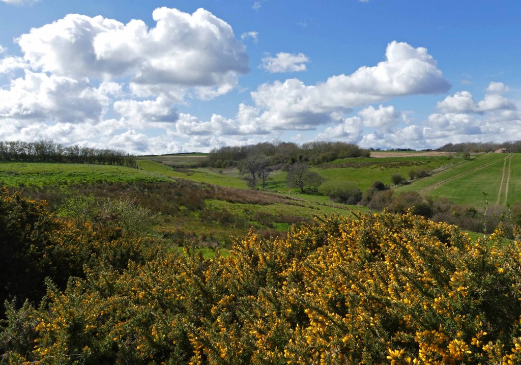
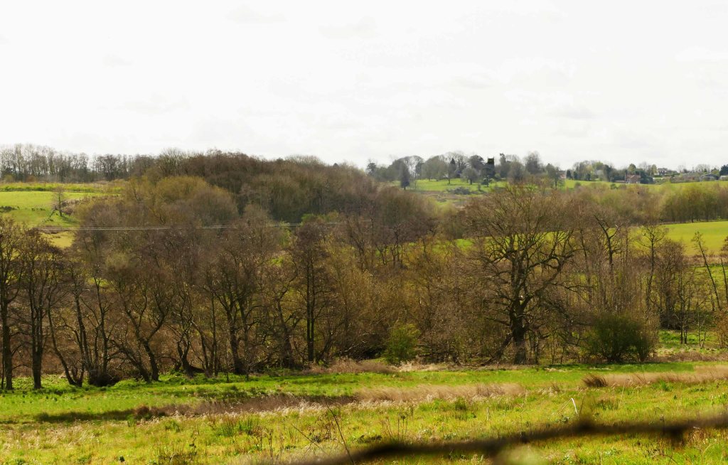
Snipe Dales Beck starts near the small dispersed hamlet of Winceby. Here the spring line between the porous Spilsby Sandstone and impervious Kimmeridge Clay beneath is just below the 100-metre contour. Six kilometres east and after a descent of eighty metres Snipe Dales Beck joins the River Lymn where this same geological boundary is nearer to forty metres asl. With the thickness of the sandstone in this part of the Wolds only being 10 to 15 metres this is only made possible due to the tilt of the rock downwards from southwest to northeast at a rate of about twenty five metres per kilometre. The beck’s watershed coincides with the A158 to the north and the B1195 to the south with just two lanes crossing the dale and a third at Sausthorpe marking the dale’s end. Because of the continuity of the geology described, the character of the landscape alters little along the length of the dale which maintains a width of around a kilometre except for the valley of its main tributary – Milelong Dale. This means that this whole area which covers roughly nine square kilometres could have a similar diversity of wildlife as within Snipe Dales Nature Reserve. Not just along Snipe Dales Beck but also its many tributaries. This need not be one large reserve as it could still be a haven for wildlife if farms in the dale were encouraged to adopt regenerative farming methods. Encouragingly tree planting and adding ponds have already taken place.

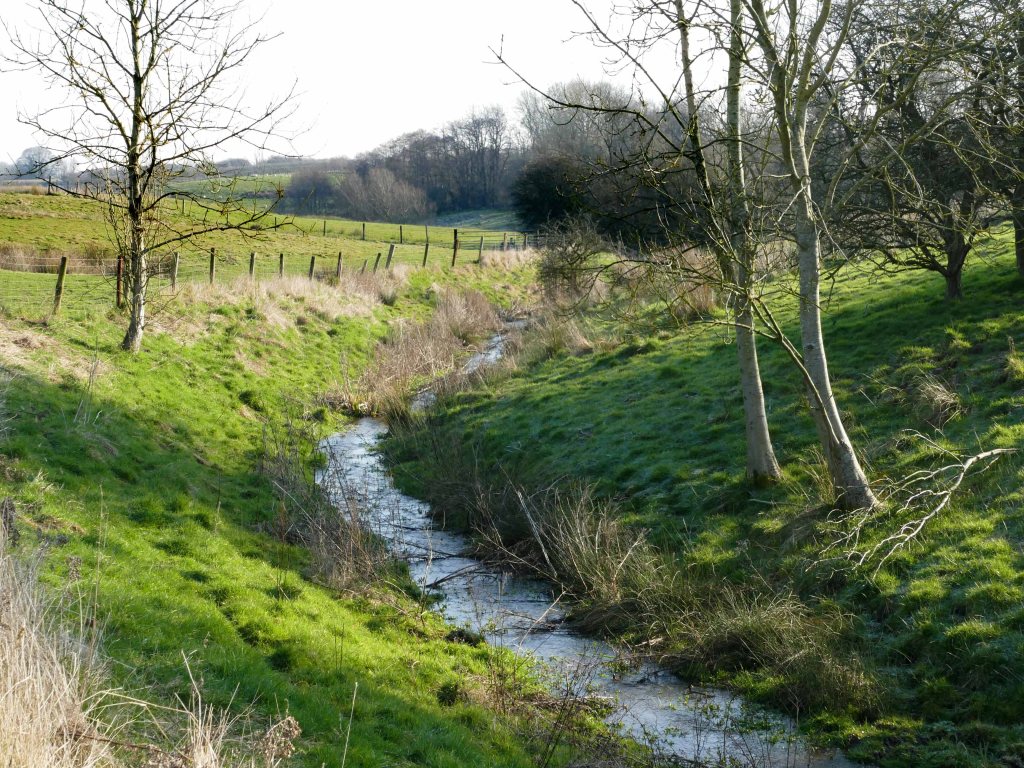
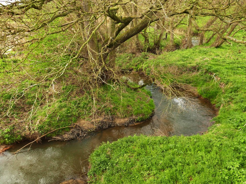
Within Snipe Dales Nature Reserve several streams emerge from springs and issues in separate deep gills along the spring line and quickly converge to form the beck a kilometre downstream. Even before becoming a reserve, these valleys were only ever rough pasture with a wet valley floor overlooked by gorse on the steep valley sides. Today, however, it is managed by the Lincs Wildlife Trust to provide a mix of habitats. The beck then flows six kilometres east to join the River Lymn close to the village of Sausthorpe but in its eighty metres descent to the river, fifty metres of this is in the first two kilometres. The beck then meanders serenely for most of the rest of its course until being diverted over its last few hundred metres. These meanders are not wiggles as depicted on even the most detailed OS maps but are more often a series of loops beneath and around a corridor of alders. This corridor is roughly fifty metres wide, at least ten times wider than the lower reaches of the beck and is an important sanctuary for wildlife offering cover and a natural corridor to move freely.
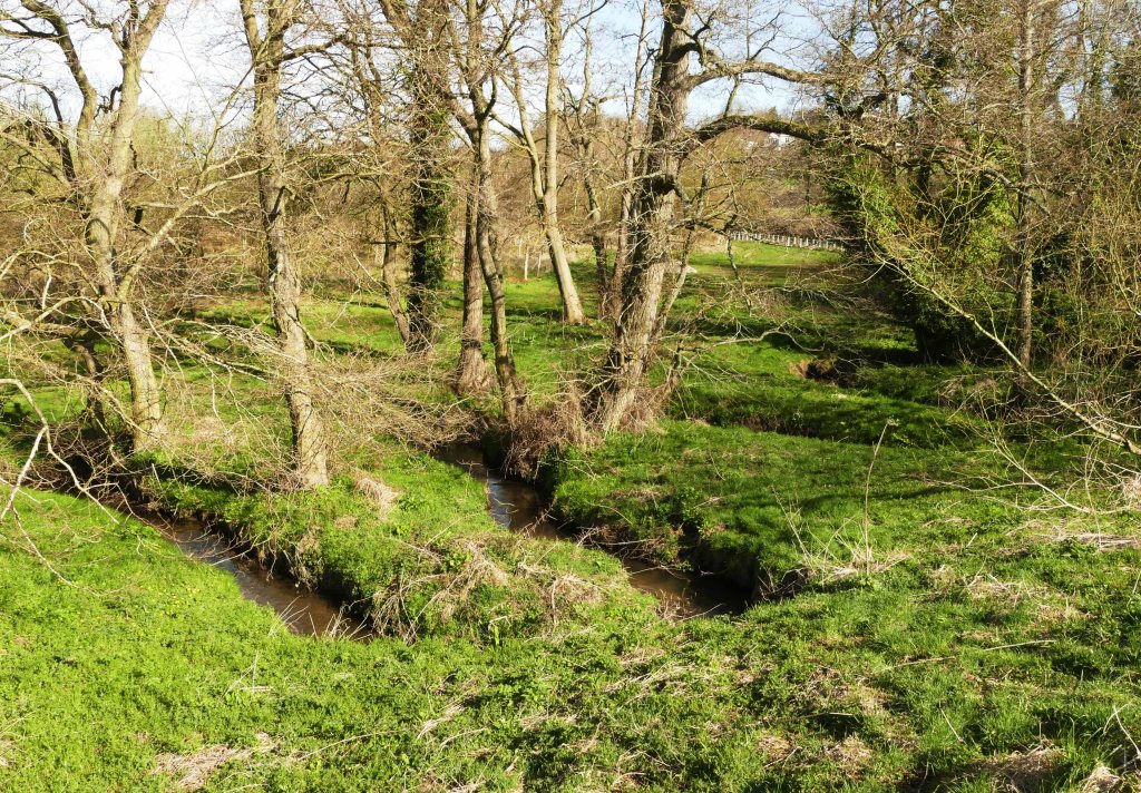
In England, it is centuries since rivers have been allowed to flow along natural courses on their way to the sea. This is because they have nearly all been straightened for the sake of navigation or drainage but with a consequent detrimental effect on the wildlife that relies on the associated riverine habitat. Fortunately, much of Snipe Dales Beck still retains its natural course although this is not apparent on any map. With it mostly being hidden by trees the loops in its course have never been picked up in surveys. Now though with the aid of a drone flying just above the trees in late winter, when their branches are bare, the undergrowth dead and flattened and the beck in spate, it would not be difficult to map its precise course.
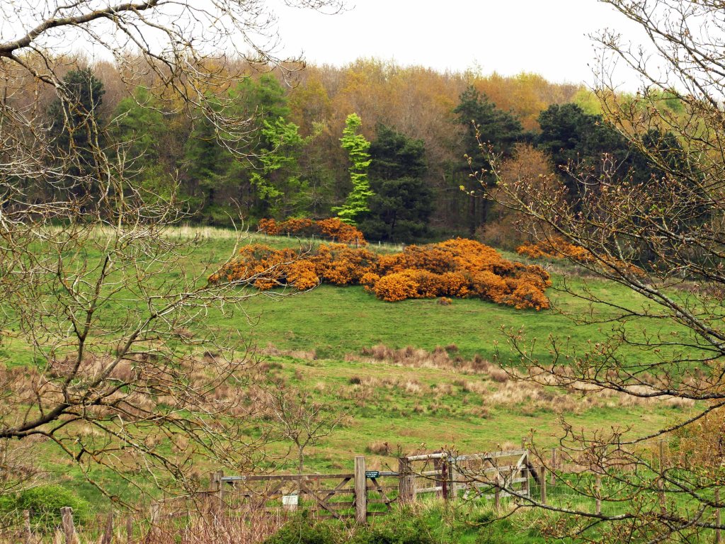
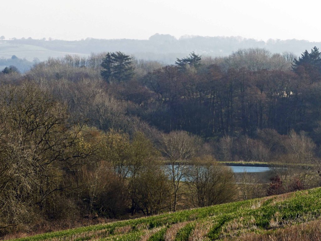
After the reserve, Snipe Dales Beck passes through a wooded country park but even beyond here, the beck stays among trees meandering erratically between alders and the occasional copse of beeches. Here on its south bank, the land is semi-natural pasture with the beck accompanied by a path that is part of the Lindsey Loop LDP. (This can be followed down the dale all the way to Raithby. See Round Routes post.) At Lusby Lane, close to a ford, the path crosses the road to then enter another nature reserve that follows the stream up to Furze Hill, after which the reserve is named. Although small, the reserve packs a lot. This is because Furze Hill is at the end of a spur of the sandstone jutting out from a ridge upon which the long village of Hagworthingham stands. This high point overlooking the river offers fine views back up the dale. Extending almost to the beck the spur also gives a final chance to observe close up the contrast of the dry gorse covered hill and the wet pasture beneath interspersed with damp tolerant blackthorn bushes. Here water surfaces at the boundary between the sandstone and underlying clay close to the beck.
Fortunately, though boggy in places, it is still possible to follow a path that crosses the beck a couple of times before returning to its south bank. On this side, because the sandstone has receded away from the beck forming a series of prominent spurs between small valleys, the land close to the beck is arable. When the path and beck finally part ways the former steadily climbs out of the valley via one of the prominent spurs and near the top of the climb there again is the area of tussocky, boggy ground at the boundary between sandstone and clay despite being more elevated this time Immediately above this are patches of gorse overlooking the small valley containing a tiny tributary of Snipe Dales Beck.
From this point the footpath rises to 75 metres asl from where there are wide views north across the dale to the ridge opposite along which the A 158 heads east. This is also the ridge on which Hagworthingham stands at the same height as our footpath. From this viewpoint, the opposite ridge looks to be a continuous line of sandstone but to the west of the village the main road descends from being above one hundred metres on Claxby Ironstone dipping down to 75 metres on the sandstone on which the Hagworthingham stretches, straddling the road. Beyond the village, though not apparent from this view, there is a break in the sandstone causing the road to dip down into a damp valley before recovering height back up to 70 metres for a kilometre on an outlier of sandstone. The main road then takes a long winding route down to the floodplain of the River Lymn while a lesser road veers southeast from where a prominent white house stands out on the horizon opposite. Using another spur of sandstone it makes a gradual descent down to Raithby Bridge crossing Snipe Dales Beck and then climbs towards Mavis Enderby.
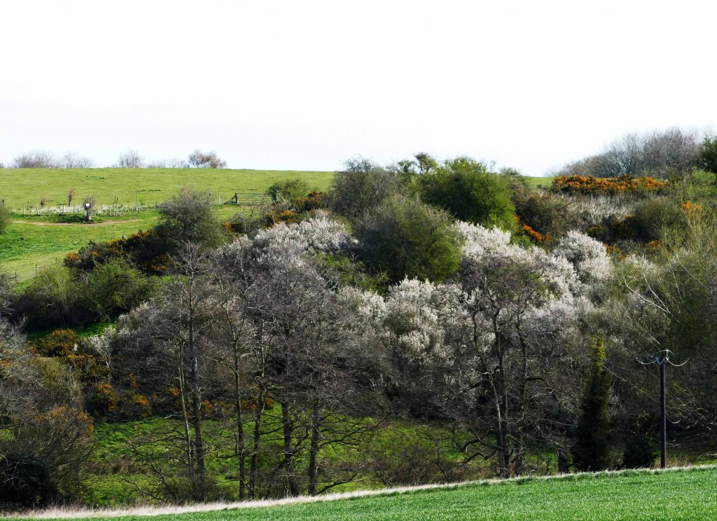
Back on the footpath after passing lonely Northfield Farm, views of Mavis Enderby appear on the hill ahead overlooking the steep and wooded Milelong Dale. Straight ahead is Furze Hill Covert whose name suggests that at least the west side of the dale was once less wooded and more grazed in the past, similar to the one we have just left behind with gorse overlooking the valley. Furze in these parts being the old name for gorse as in Furze Hill Nature Reserve, which parts of Milelong Dale might once have resembled. With the uniformity of geology along the length of Snipe Dales Beck Dale as displayed in the several geological cross-sections in the next post it would be expected that land use in previous centuries was also fairly uniform along the length of the dale with only in the last century different landowners choosing contrasting ways to manage the land with the choice of how intensively to farm it with the next section of the walk displaying an interesting mix of land use.
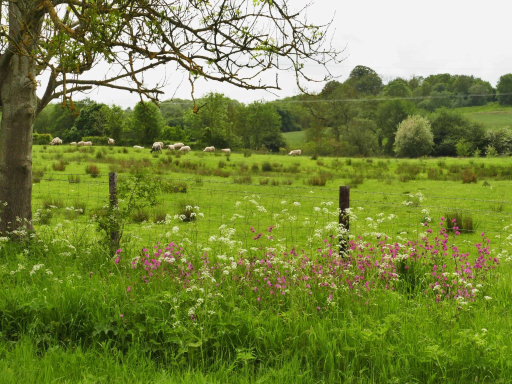
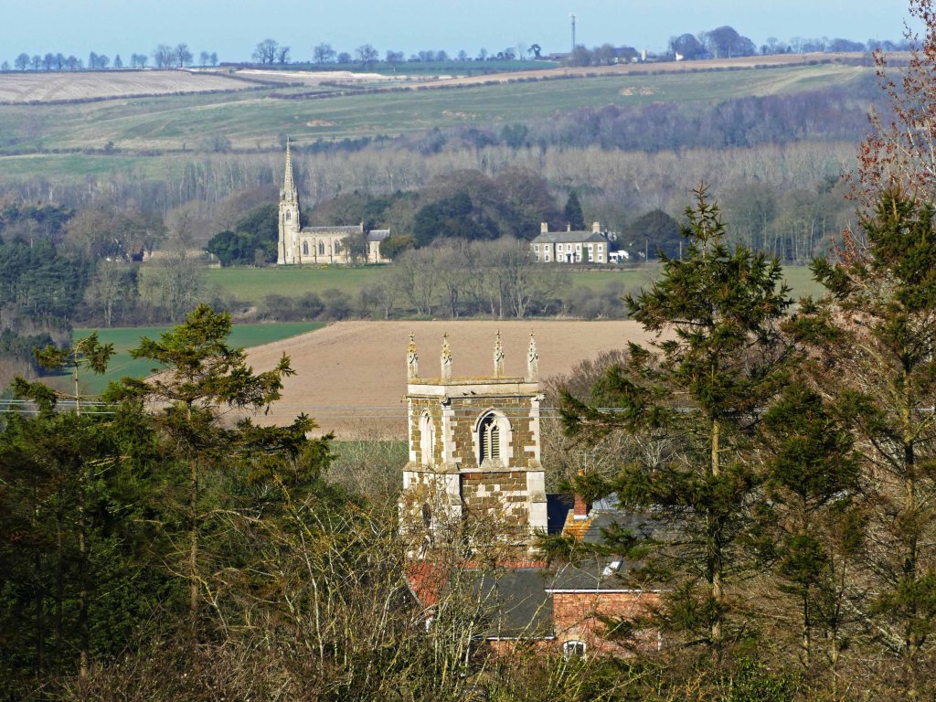
After another kilometre the footpath approaches Mavis Enderby but not before offering fine views across the usually hidden Milelong Dale filled with ponds and woods some of which are SSSIs. The dale all belongs to one farm which fortunately seems to have always had a sensitive approach to managing this beautiful hidden valley and offers a mix of habitats for wildlife. The path then dips down into the narrow valley near the headwaters of Milelong Beck and crosses more boggy ground as the path also dips below the boundary twixt sandstone and clay. Beyond the stream, the climb up to Mavis Enderby is steep and tricky where it again crosses back over this geological boundary. Here it is necessary to pick a way through a tussocky tract of boggy ground with only the church tower of St. Michael as a guide to the right direction.
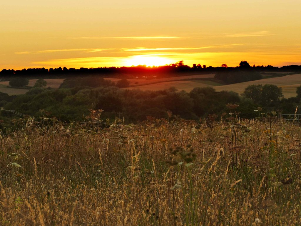
St. Michael’s is the most impressive church in the dale which it overlooks from a commanding position. As with all other churches in the area, it stands on Spilsby Sandstone which is also the preferred local building stone, although as with St. Michael’s many have been restored during the Victorian era using imported stone. St. Peter’s in the neighbouring village of Lusby, is by far the oldest church in the area, having changed little in the last thousand years. It too stands in a position overlooking the dale. This was also the case with Winceby, which once stood at 110 metres asl and with the possible exception of Normanby le Wold must have had the most dramatic site of any church in the Wolds. This overlooks the steep declivity where Snipe Dales Beck begins its journey east, flowing fast eager to join streams from neighbouring gills. The church is long gone but the graveyard remains protected within the bounds of Snipe Dales Nature Reserve.
Topped up with the waters of Milelong Beck in its last kilometre, Snipe Dales Beck’s journey is more sedate, meandering gracefully as it enters the flood plain of the River Lymn. There are two opportunities to view the beck at this last stage of its journey. These are at two bridges, first Raithby Bridge followed by Sausthorpe Bridge. The latter actually crosses the River Lymn where the beck joins it. Both are accessed by turning north at Mavis Enderby Crossroads and a little further at Raithby Crossroads, the road splits giving access to both bridges.
The lane down to Raithby Bridge, the only actual road bridge over the beck, is bordered by thick hedging which on the left (west) has been planted with a mix of species in two rows. By the roadside, this is a typical hedgerow of shrubs and small trees but behind overlooking a flower-filled pasture there is also a line of standard trees. Both sets of planting have now grown up sufficiently to create a tunnel between them that is possible to follow if you want to avoid walking along the road. (This road is the route the Lincoln to Skegness bus takes stopping at Hagworthingham and Raithby – See Round Routes post.) There are two places where this thick hedging is broken at access points to two fields that offer wide views back up the valley towards Hagworthingham. The hedge ends before reaching the bridge and allows wider views across an interesting mixed landscape of a pond, pasture and woods back up Milelong Dale to Mavis Enderby.
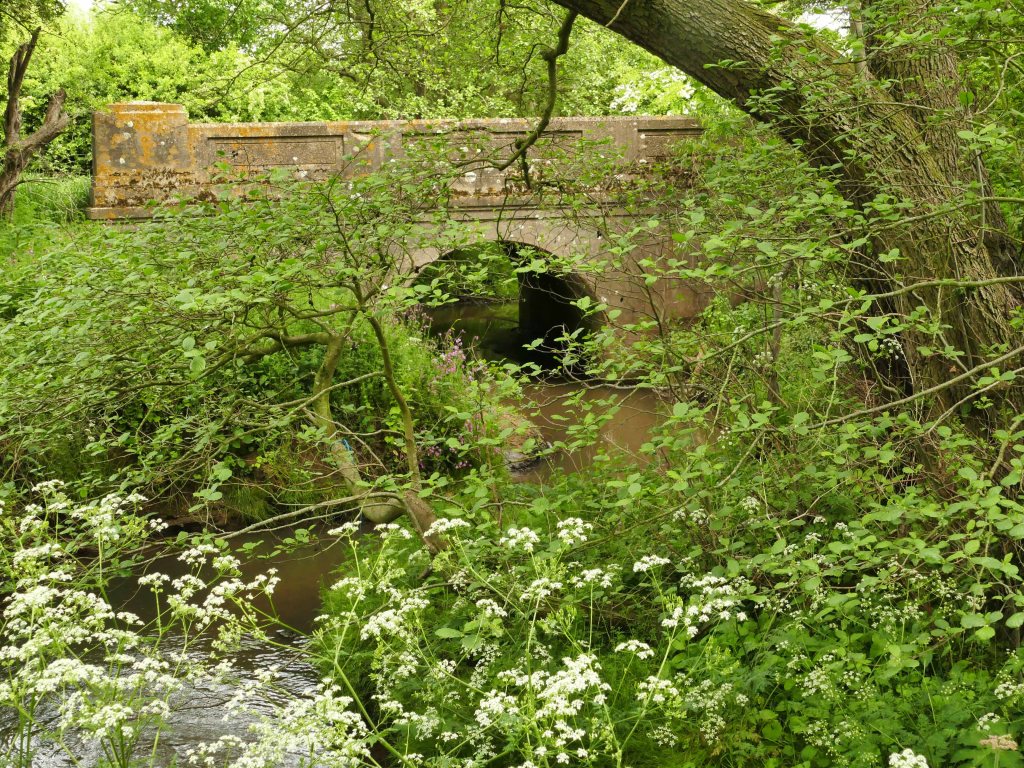
Both lanes take advantage of a broad northerly extension of the Spilsby Sandstone plateau that widens here considerably before it finally tapers towards the market town of Spilsby three kilometres further east. At Raithby Bridge the valley between the northerly extension of this plateau and the southern tip of the detached sandstone ridge that extends east from Hagworthingham is only 500 metres and must have always been an obvious crossing point of the beck avoiding too much damp valley bottom. Today the bridge that crosses the beck is a solid early twentieth-century concrete construction. Fortunately, this has had time to develop a covering of lichen helping it blend better into its setting that can have changed little over recent centuries. This however is not the case at Sausthorpe Bridge.
Although Raithby and Sausthorpe bridges are only a kilometre or so apart their settings are quite different as is the character of the beck. Raithby Bridge is peaceful, sheltered and bucolic surrounded by unimproved pasture and woodland. The beck meanders peacefully in big loops beneath overhanging alders as it has probably always done. The land around appears to be farmed with some consideration to wildlife and the rewards are quite apparent with snipe still attracted to the area. However, the lane heading towards Sausthorpe with its impressive church spire commanding the valley is straight and flat as it crosses the floodplain of the Lymn with the river at its far side. On one side of the road is an avenue of tall poplars overlooking what at first glance appears to be a ditch but is actually the last 250 metres of Snipe Dales Beck. This hurries along the narrow cut to join the River Lymn next to Sausthorpe Bridge. Beyond the bridge, the lane climbs suddenly to enter the village by the church where it then crosses the busy A 158 coast road.
Less than a hundred years ago the scene would have been more similar to that at Raithby Bridge with the beck still following its natural meandering course across the floodplain well away from the lane crossing a wet meadow of wildflowers, grasses and nesting lapwings but today this is just another bare arable field whose main characteristic is that it floods easily in winter. It is a sad end to a beck that for the rest of its journey has managed to flow along a natural winding course crossed only by one road bridge and free of buildings but protected by a natural corridor of trees for most of its journey.
If you are unable or do not have time to explore all of Snipe Dales Beck dale then at least visit Raithby and Sausthorpe bridges to compare the different landscapes and farming practices and see which you prefer. Maybe your preference lies with the bare efficiency and straight lines over a tangled and more unkempt appearance, but don’t think the latter is less important as there is now a move back to regenerative farming which is not only good for wildlife but also for the planet by locking carbon back into the soil. This helps retain moisture and reduces the risk of local flooding.
In the case of Snipe Dales there is the opportunity to recreate in miniature the landscape of the area as it was in the eighteenth century as described in an earlier post about Sir Joseph Banks. Then, particularly in the soke or wapentake of Bolingbroke, it was common practice to move stock from the dry Wolds in high summer down to the Fens where they could fatten up on fresh rich pastures before being sent off to market. By returning the land around the old confluence of the River Lymn and Snipe Dales Beck to how it was just a hundred years ago as a low-lying wet meadow allowed to flood in winter, then this ancient practice of moving stock down from the surrounding hills to be fattened on rich pastures could be recreated on a small but specialist scale. The benefits would be wide-reaching by producing a specialist, quality product while providing a habitat for wildflowers, birds and insects. It would also make Snipe Dales Beck the only watercourse in Lincolnshire that meanders naturally, as nature intended, along the whole length of its course.
Now quiet by-lanes before the Black Death in 1348, when Lincolnshire was one of the most populous and wealthy counties in England, there were once important routes from the coast to its hinterland. Wool underpinned the county’s wealth, travelling for export in one direction while salt, a basic essential of an agrarian economy headed inland from the coast. At this time Boston was the second busiest port in the country after London and its main road inland went north along a causeway across the Fens (Following the terminal moraine of the Last Glacial Maximum.) to the foot of the Wolds where it continued up Keal Hill and across the sandstone plateau to Mavis Enderby. Here it was crossed by another road heading inland from the busy port of Wainfleet on the Lymn Estuary when both the river and coast had a different profile. At Raithby Crossroads the road north forked. The Raithby Bridge fork headed inland to Horncastle but the Sausthorpe Bridge fork continued north to link up with the Bluestone Heath Ridgeway and beyond that to Louth and the Barton Street which extends as far as the River Humber. (See Langton Old Road.)
These were also drove roads used in summer, right up to the time Tennyson was born, to move huge flocks of sheep off the parched hills and down to the lush grazing of the Fens only to return a few months later before the return of the winter floods. Particularly in Bolingbroke Wapentake this practice had been going on for at least a thousand years and possibly much longer. It finally ended with the enclosing of common land followed by the gradual draining of the Fens but not before the spectacle was recorded by no less a figure than Sir Joseph Banks. A major local landowner, who was ironically a leading advocate for change but was also the foremost naturalist of his time. in his later years voiced some regrets due to the detrimental impact on wildlife that the changes, like the wholesale draining of the Fens, he had advocated had wrought. (See Sir Joseph Banks post.)